
 Login

This Is the Hurricane Season El Niño Foretold
Updated at 1:36 p.m. on October 10, 2026
For more than four months, since this hurricane season began, the Atlantic has been eerily placid—a remarkable stretch without a single hurricane. That prolonged calm has been rudely interrupted by Hurricane Isaias, a Category 2 fastball that slammed into the Gulf Coast last night along the Florida panhandle. “I think we knew at some point we would likely have a hurricane,” Daniel Brown, the operations-division chief at the National Hurricane Center, told me.
Not to be outdone, the Pacific Ocean has two major storms brewing, including Hurricane Simon, a dangerous Category 4 storm off the coast of southwestern Mexico. A smaller one, Tropical Storm Rachel, is forecast to bring potentially more storm surge and flooding as far north as Southern California. “It’s a busy day here,” Brown said on Friday.
This season’s dynamic—an unruffled Atlantic and a frothing Pacific—has been right out of the El Niño playbook and was predicted months ago. El Niños tend to generate opposing winds—low-altitude trade winds out of the east and higher-up westerlies—that tear apart Atlantic storms as they try to form and also keep them from gaining strength. This type of wind shear is affecting Hurricane Isaias now, Brown said, and weakened the storm a little before it made landfall.
Isaias landed along the Gulf Coast with sustained winds of more than 100 mph; in places, it dropped more than a dozen inches of rain. Coastal counties had ordered evacuations; the governors of Alabama and Florida had declared emergencies; residents had scrambled through hurricane prep. During the storm, the wind ripped off roofs and toppled tree. t\Two people, one in Florida and one in Alabama, died after trees fell on their house, authorities said. Nearly 800,000 people were without power across the Southeast as of Saturday morning, according to poweroutage.com.
In the Pacific, by contrast, a Category 4 hurricane is almost par for the course this season. By this time of year, the Pacific has usually generated 13 storms potent enough to warrant their own name, Brown said. This year, we’re on number 19. This onrush of hurricanes has a great deal to do with the buildup of abnormally warm waters in the equatorial Pacific—which, at this point, are in certain areas more than 4 degrees Celsius warmer than usual. This warming gins up storm activity in that ocean; it’s been spinning up hurricanes and hurling them toward Hawaii for months. The storm swells have also eroded Southern California beaches and swamped homes, and they keep coming. On Friday, seawater flooded the streets of Balboa Peninsula, California, inundating cars and homes, well before Tropical Storm Rachel was anywhere close to arriving.
The coast of Mexico is at particular risk from Hurricane Simon, which is forecast to bring potentially dangerous flooding and landslides to coastal states such as Jalisco and Nayarit. Further north, on the Baja California peninsula, communities are still recovering from the effects of Hurricane Polo, which caused widespread flooding last month and displaced hundreds of people.
The storm scorecard in these oceans has only reinforced the notion that the world is in the midst of an unusually powerful El Niño. As I reported in August, key areas of the Pacific Ocean had already gotten hot enough to make this a “Super El Niño”; the experts I spoke with then were anticipating that the event could end up peaking at twice that amount of warming. If those trends hold, this could be the strongest El Niño ever recorded, and right now, “everything seems to be on track with this being a remarkable event,” Nick Novella, a National Weather Service meteorologist, told me.
This season has set a record already—this is the latest in the year that a hurricane has formed in the Atlantic at any time during the satellite era, since 1966. And it isn’t even close. “This record was broken by nearly a month,” Novella said. Normally, five Atlantic hurricanes form by the end of September. For residents of the Gulf Coast, the beleaguered hours after a storm makes landfall are all too familiar. As they assess the wreckage, hopefully the year’s first Atlantic storm will not have changed too dramatically how we remember this season of relative calm.
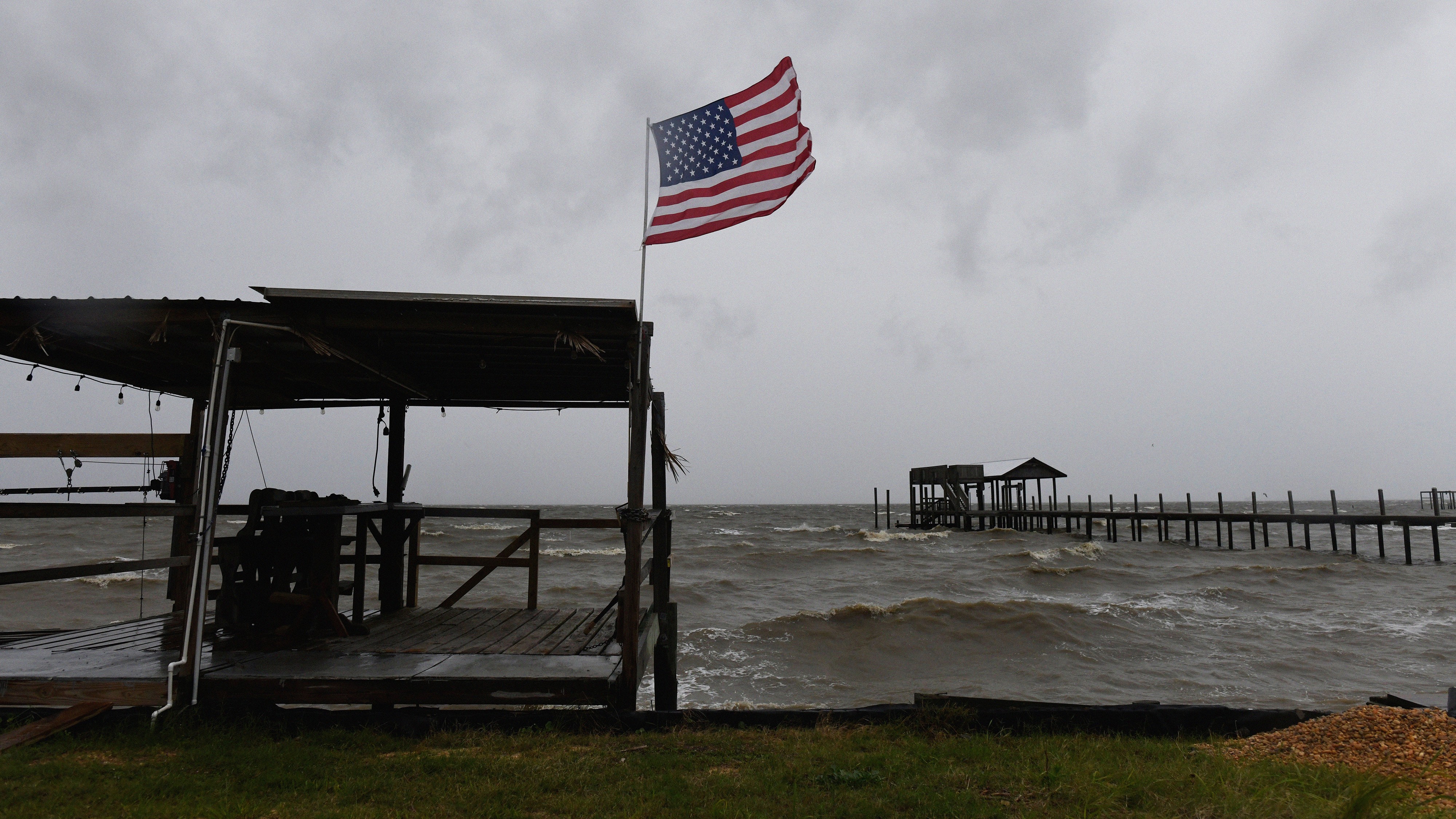
© Octavio Jones / AP
