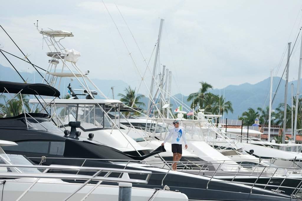
Hurricane warning in effect from Manzanillo to Cabo Corrientes as storm moves toward Pacific coast
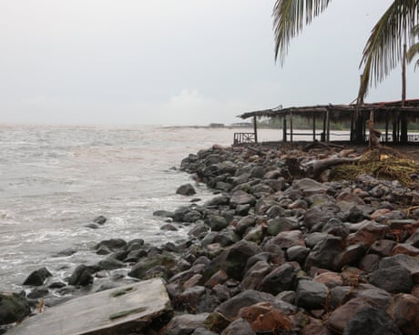
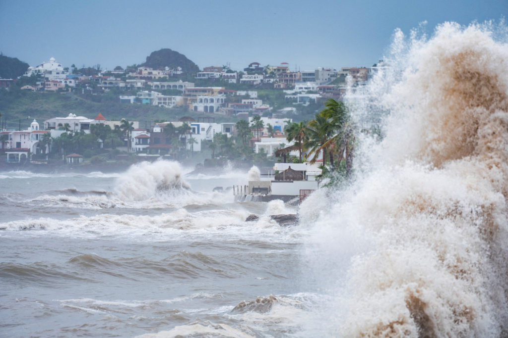
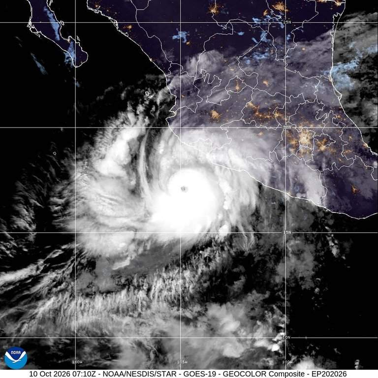
Trudy strengthened to a category 2 hurricane as it moved toward Mexico’s south-western and west-central Pacific coast on Saturday, the US National Hurricane Center said.
A hurricane warning was in effect from Manzanillo in Colima state to Cabo Corrientes in Jalisco. The latest NHC data showed Trudy with maximum sustained winds of 100mph (155km/h) and about 205 miles (330km) south/south-east of Cabo Corrientes and 115 miles (180km) south/south-west of Manzanillo, moving north-west at 10mph (17km/h).
We went aboard a cruise ship navigating some of the world's most dangerous waters. In the Arctic, drifting icebergs, sea ice, sudden storms and fierce winds make sailing unpredictable. Yet every year, around 100,000 cruise passengers travel to Greenland to explore its remote coastline and experience one of the world's last great wildernesses.
Hurricane Trudy weakened to Category 1 on Friday off Mexico’s Pacific coast, after data gathered by a hurricane-hunter aircraft, but the country’s National Meteorological Service (SMN) kept its alert for intense rain in the south and west of the country.
The downgrade came hours after the storm reached Category 3 in the early morning hours and registered Category 2 around midday, the National Meteorological Service (SMN) said in an update.
At noon local time, the center of the cyclone was located about 370 kilometers southwest of Acapulco, in Guerrero state, and 515 kilometers south-southeast of Manzanillo, in Colima state, but it was moving north-northwest at seven kilometers per hour.
The adjustment followed a warning earlier in the day from National Meteorological Service’s coordinator Fabián Vázquez Romaña, who told the presidential news conference about the storm’s rapid intensification and a forecast that it could reach Category 4 before approaching the coasts of Colima and Jalisco on Sunday.
Hurricane #Trudy is nearing the coast of #Mexico, which is expected to see MAJOR IMPACTS in the form of flooding as over 400mm of rain could fall! A #Hurricane Warning is in effect. Will have a stream up tonight to answer your questions! pic.twitter.com/GY9V47IK5O
Mexican President Claudia Sheinbaum urged residents of the regions under alert to follow official civil protection notices and to go to temporary shelters if they are in risk zones or near riverbeds.
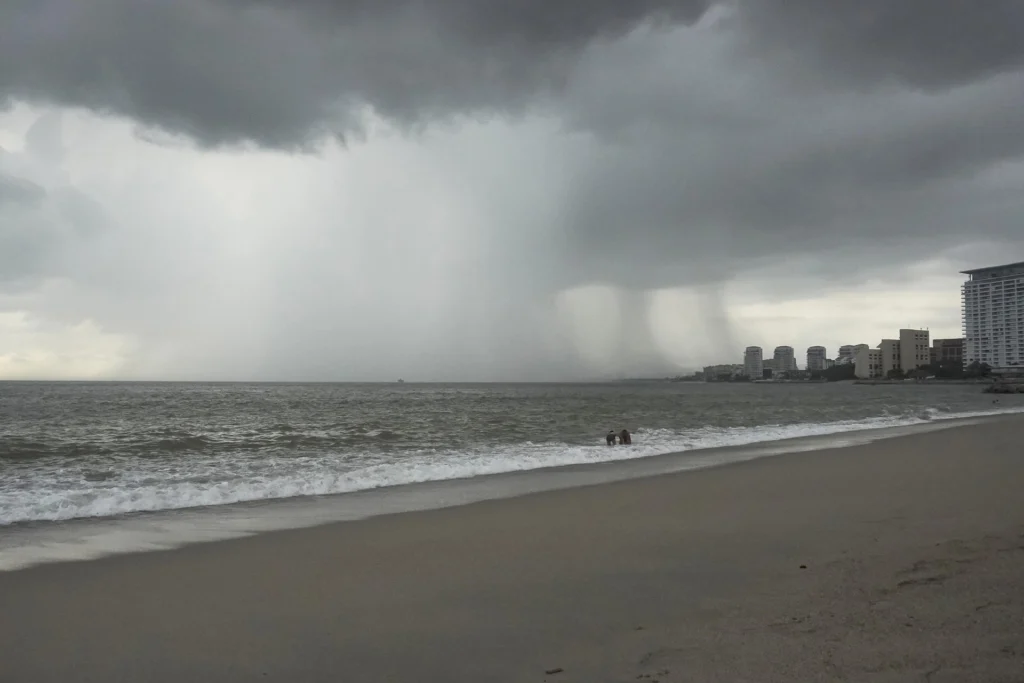
The National Meteorological Service said the storm’s circulation will bring intense rainfall to the states of Guerrero, Oaxaca, Colima and Michoacán. Mexican authorities, working with the U.S. National Hurricane Center, maintain a hurricane-wind watch zone from Manzanillo, Colima, to Playa Pérula, Jalisco.
The agency warned that the rain could cause landslides, rising rivers and streams, overflows and flooding in low-lying areas of the affected states, and urged the public to follow civil protection recommendations.
Double trouble in the eastern Pacific! 🌀🌀 Tropical Storm Simon is threatening Mexico's west-central coast with ongoing torrential rain and dangerous seas, while nearby Hurricane Trudy could rapidly intensify into a major hurricane in the coming days. https://t.co/DepkchVHhZpic.twitter.com/NjcysAgoDU
A second system is also churning in the Pacific. Tropical Storm Simon was located 220 kilometers south of Cabo San Lucas in Baja California Sur and 445 kilometers west of Cabo Corrientes in Jalisco.
Simon carries winds of 65 kilometers per hour and drifts northwest at 15 kilometers per hour. It will generate very heavy rains, wind gusts reaching 50 kilometers per hour and swells of two to three meters along the southern portion of Baja California Sur.
The presence of two active systems on the same coastline complicates the response. Emergency planners must track the slow-moving Trudy as it threatens Guerrero, Colima and Jalisco while Simon feeds moisture into Baja California Sur hundreds of kilometers to the north.
Trudy’s sudden weakening does not remove the danger. Forecasters stress that the downgrade reflects current wind speeds, not the rainfall threat, which remains substantial and stretches well beyond the storm’s center.
The storm’s seven-kilometer-per-hour drift means it will linger over the region longer, unloading rain on the same watersheds hour after hour. That pattern, rather than wind alone, drives the risk of flash floods and mudslides in mountainous terrain.
Mexico has strengthened its early warning systems in recent years, and the morning presidential briefing reflected an effort to keep the public informed before the storm’s most dangerous phase arrives. President Sheinbaum’s appeal to use temporary shelters framed the government’s priority as protecting lives ahead of property.
The coming days will test that preparation. Trudy may regain strength if conditions over the Pacific shift, and the projected approach to Colima and Jalisco on Sunday keeps coastal communities on edge.
For now, the alerts remain in place and the message from authorities is consistent: the storm has weakened, but the rain has not, and the hours of greatest risk still lie ahead.
After a late taste of summer in October, Portugal is heading for a cooler weekend. Temperatures will fall most noticeably in the northern and central interior, while the Algarve should
Landslide blocks river and triggers downstream flooding, while summer temperatures persist in Portugal
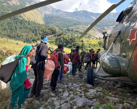
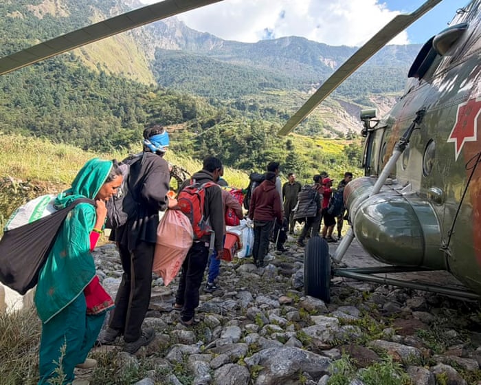
Flash floods have swept through Nepal’s central Gorkha district after a pre-dawn landslide on 11 October blocked the Budhi Gandaki River, triggering severe downstream flooding. Two villages in the worst-affected Chumanubri rural municipality were reportedly destroyed, with homes, roads and bridges washed away. Part of a hydropower station was also damaged.
After river levels surged from 2 metres to nearly 8.5 metres within hours, the national disaster risk reduction and management authority reported that 204 homes were damaged, and more than 650 people had been affected. More than 100 foreign trekkers were stranded in the popular hiking region. The floods come just two months after catastrophic flooding and landslides devastated parts of the country on the border with Tibet, leaving thousands dead or missing.
One person has died as stormy weather with high volumes of water is sweeping across Greece, affecting mostly Greek islands. Rhodes is one of the Greek islands severely hit by the bad weather front, while Evia and the Sporades islands (Skiathos, Skopelos and Alonissos) are also at the mercy of the intense weather phenomena. RHODES […]
Spain recorded 5,807 heat-related deaths during the summer of 2026, the highest figure in a decade, according to the national mortality monitoring system (MoMo).
The estimate, reported on Tuesday, is based on final data collected between May 15 and September 30, the period covered by the National Plan for Preventive Actions against the Effects of Excess Temperature on Health.
The toll surpasses the two deadliest summers since the series started: 2022, with 4,789 deaths, and 2025, with 3,832.
It is more than 51% above last year’s figure and 188.61% of the 2024 total, when 2,012 deaths were estimated. Even so, it remains well below the summer of 2003, when around 13,000 people died in Spain because of heat, a catastrophe that led the Health Ministry to design a national prevention plan.
🌡️ September 2026 was the 2nd warmest globally & 3rd warmest in Europe on record.
🇪🇺 Western Europe saw exceptional heat, with parts of France, Portugal, Spain & Italy 4–6°C above average.
August produced the most fatalities, with 2,162 deaths. July followed with 2,026, then June with 938, September with 559 and May with 123.
Compared with last year, the 2026 toll stands more than 51% higher. Measured against 2024, the increase reaches 188.61%, a year in which the system calculated 2,012 deaths.
The number has not reached the historic summer of 2003, when roughly 13,000 people died in Spain as a result of high temperatures. That catastrophe prompted the health ministry to design and launch a prevention plan for the effects of heat on health.
The elderly again bore the heaviest burden. Some 97% of estimated deaths attributable to heat occurred among people aged 65 or older, and 62% among those over 85.
Women were disproportionately affected, accounting for 3,486 deaths, or 60% of the total. Men accounted for 2,321. The impact was not uniform across the country, with the highest mortality rates recorded in the north and northeast of the peninsula.
A Year of Extreme Weather
The team coordinating MoMo at the National Epidemiology Center attributes the impact to an exceptional climatic context. It described this summer as the warmest in recent history, with four heat waves identified by the State Meteorological Agency, plus an additional one in early September.
A persistent drought, large wildfires and an intense marine heat wave in the western Mediterranean compounded the situation. Those conditions combined to push mortality to levels not seen in the decade of MoMo records.
The Carlos III Health Institute said the data reinforce the importance of continuous epidemiological surveillance and stronger prevention and adaptation measures against extreme heat. The warning carries weight as climate patterns grow more volatile.
Scientists have linked the exceptional summer to broader climatic shifts, including the Super El Niño phenomenon. Studies suggest that phenomenon could cause heat-related deaths of 451,000 people worldwide over the coming six months.
Greece’s National Meteorological Service EMY upgraded its weather alert to a “Dangerous Weather Phenomena” warning. At the same time, the country’s Civil Protection declared already 7 regions including several islands in the Aegean Sea into “Red Code” alert warning of very strong winds and possible flooding phenomena. Red Alert has been declared for the island […]
A weather deterioration in Greece is forecast for the next couple of days and the National Meteorological Service (EMY) has issued an “orange” warning, that is Category 4. The main features of the new spell of bad weather will be intense weather phenomena locally, a drop in temperature, and strengthening winds over the seas. According […]
Portugal is heading for another spell of unusually warm weather, with temperatures expected to rise next week and exceed 30°C in some regions, according to forecasts. The warmer conditions are
The eye of Hurricane Simon was just off the Pacific coast of Mexico early Sunday and was expected to move inland later in the day as an extremely powerful storm.
The eye of Hurricane Simon was just off the Pacific coast of Mexico early Sunday and was expected to move inland later in the day as an extremely powerful storm.
The National Hurricane Center in Miami said early Saturday Simon's maximum sustained winds increased to 145 mph (230 kph). A storm of that strength is considered a major hurricane.
The National Hurricane Center in Miami said early Saturday Simon's maximum sustained winds increased to 145 mph (230 kph). A storm of that strength is considered a major hurricane.
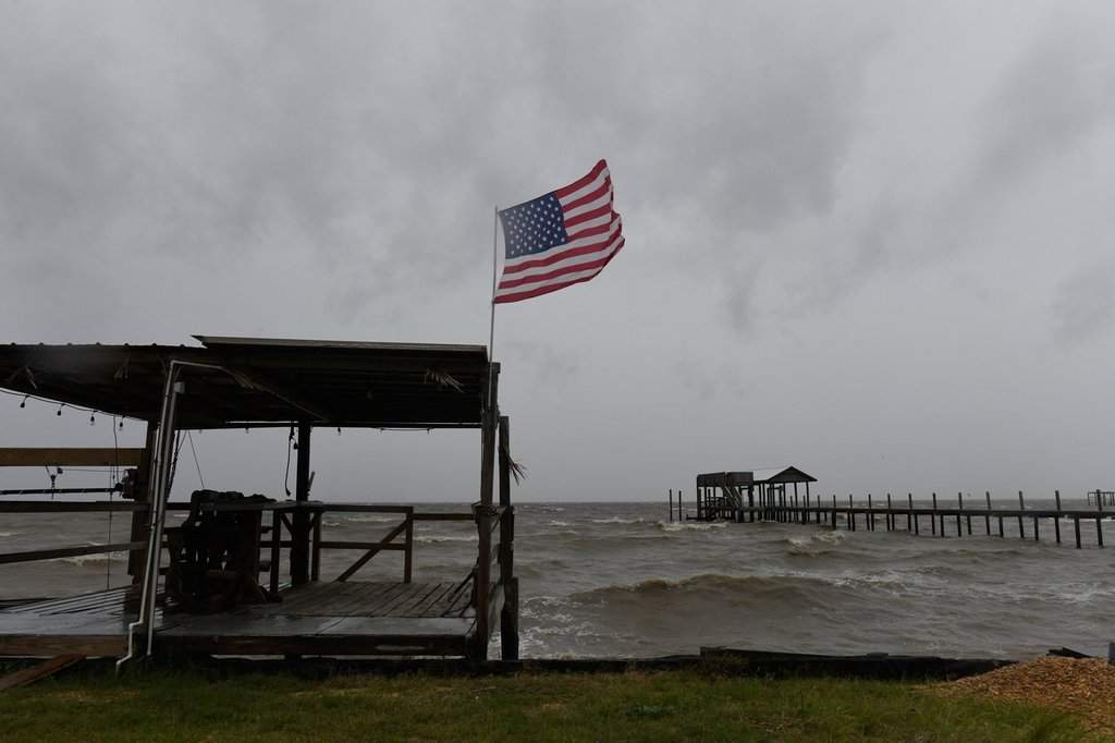
Isaias weakened overnight and was no longer considered a hurricane but flash flooding threats and the potential for tornadoes persisted Saturday as the storm moved inland.
Isaias weakened overnight and was no longer considered a hurricane but flash flooding threats and the potential for tornadoes persisted Saturday as the storm moved inland.
Eight million properties in Britain are at risk of flooding by mid-century due to climate change, the Environment Agency has claimed. That's a quarter of the total. It's completely preposterous, says Paul Homewood.

 Login