❌

Reading view

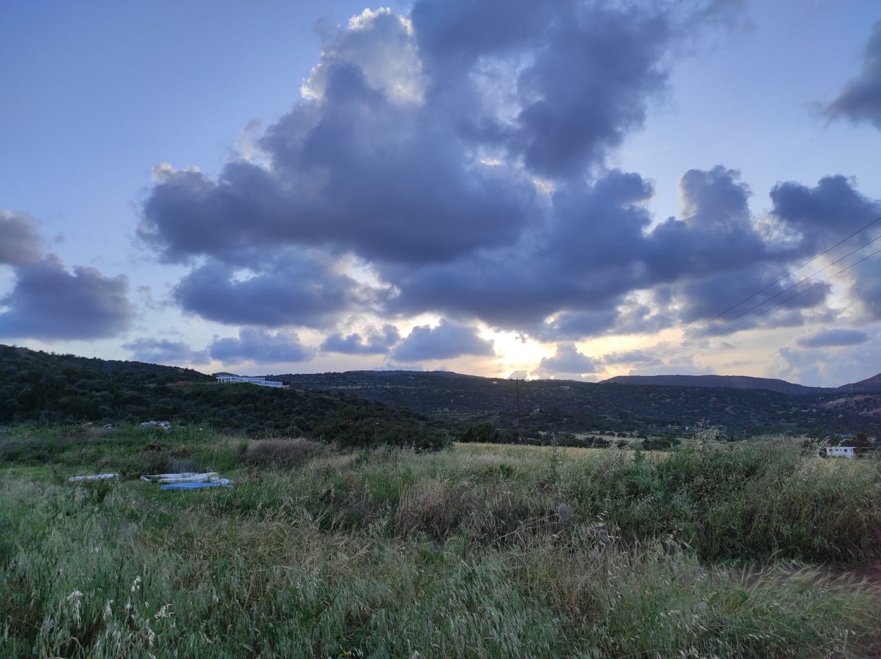
Fine weather with scattered clouds and fine dust in between

Friday brings mainly fine weather, with a few scattered clouds and fine dust in the atmosphere.

Winds will be a northwest to northeast gentle to moderate breeze of 3 to 4 Beaufort, over slight seas.

Temperatures will reach 31C inland, 28C along the coast and 21C in the highest mountains.

Friday night will be clear with temperatures dropping to 19C inland and along the coast, and to 11C in the highest mountains.

Winds will be a northwest to northeast gentle breeze of 3 Beaufort, over calm to slight seas.

Fine weather continues into the weekend and on Monday, with passing clouds.

Temperatures will gradually decrease to reach the seasonal average by Monday.

  •  

Heat killed ‘staggering’ 50,000 people in Europe’s cities this summer, scientists warn

People succumbed to heat at highest rates in Malta, Italy and Hungary, with health issues, loneliness and poverty exacerbating toll

Heat killed a record 50,000 people in European cities this summer, new research suggests, with scientists blaming climate breakdown for two in every three of the deaths.

Morgues and funeral homes filled with bodies from June to August as the heat added by planet-baking pollution cut short an extra 32,000 lives in urban areas, the researchers found. Hot days pushed vulnerable bodies into overdrive and warm nights prevented them from recovering.

Continue reading...

© Photograph: Anadolu/Getty Images

© Photograph: Anadolu/Getty Images

© Photograph: Anadolu/Getty Images

  •  

Paraguay Evacuates 4,200 Families as Parana River Overflows

Inhabitants of the coastal neighborhoods in the department of Alto Parana face the rising waters after the continuous rains. Photo: EFE.

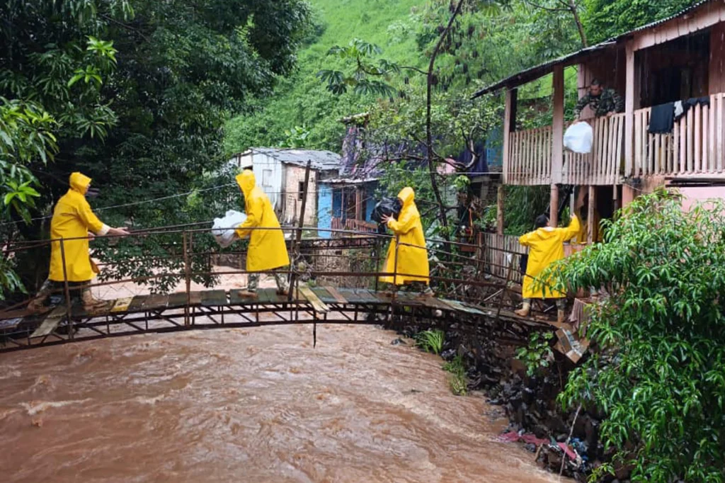
Severe flooding caused by heavy rainfall and the rising Parana River has forced the evacuation of some 4,200 families in eastern Paraguay, with local authorities monitoring vulnerable areas to move residents into temporary shelters.


More than 1,000 severely damaged homes are concentrated in the municipality of Ciudad del Este, where the rising waters have swallowed entire parcels of land. Remansito neighborhood was hit hardest. Around 35 families who work in recycling had to abandon houses submerged under the floodwater.

The emergency extends beyond that city. In the department of Ñeembucú, severe flooding has been reported in the towns of Ayolas and Cerrito. Local authorities and rescue teams continue to watch the most exposed areas as they coordinate the transfer of affected residents to temporary shelters.

RELATED: El Niño Phenomenon Reaches “Super” Category: Unprecedented Ocean Warming

The scale of the crisis has grown quickly. Just days earlier, official figures put the number of affected households at 3,000, a count that has now risen above 4,200 as the river keeps climbing.

Residents along the riverbank say the situation worsens considerably each time the gates of the Itaipu Binacional hydroelectric dam open. They argue that releasing the reservoir’s excess water has an immediate and direct impact on homes built along the coastal strip.

#Paraguay | Families in La Rivera have been affected by flooding along the Paraná River, with rising water levels impacting homes and surrounding communities.
Footage captures the extent of the flooding and the challenges faced by residents as they deal with its consequences.… pic.twitter.com/7GKTOoXEnB

— teleSUR English (@telesurenglish) October 23, 2026

Dam Blamed, Rain Persists

Representatives of the hydroelectric facility defended the maneuver. The gate openings, they said, respond strictly to technical safety protocols established for operational contingencies. The dam’s administration rejected the claim that these operations are the main cause of the river overflowing in the region.

The dispute places technical necessity against lived experience. For the communities watching water pour into their streets, the relationship between the releases and the flooding feels direct. For the dam operators, the gates are simply doing what they were designed to do under extreme conditions.

The national weather agency has offered little relief. Projections from the Directorate of Meteorology and Hydrology warn that rain will continue falling through the weekend across the country’s eastern zone. The agency urged the public and protection agencies to maintain precautionary measures amid the risk of new landslides.

Pictures show flooding along the Parana River after heavy rains and people travelling by boat through a flooded neighbourhood in Ciudad del Este, Paraguay, October 21, 2026.

📷: REUTERS

Visit our website: https://t.co/vVwYJv8osA#GeoNews pic.twitter.com/Pagii2Qdxa

— Geo English (@geonews_english) October 22, 2026

Solidarity has also moved through the affected areas. Neighbors in working-class sectors have organized to supply community kitchens and distribute donations of basic goods. That support network has become essential for families who left their homes with little more than what they could carry.

The flooding follows a pattern familiar to the region. The Paraná River, one of South America’s largest waterways, regularly swells after sustained rains, but the current emergency has outpaced local capacity to respond.

With the forecast showing no break in the weather, the number of displaced families could continue to rise. Shelters are filling, and the most vulnerable households, including those who earn their living from recycling along the riverbank, face an uncertain wait before the waters recede enough to return.

  •  

A possible three tornados wallop Arizona, bringing golf-ball sized hail

Violent storms overnight knocked over utility poles and trees and carried thunder and heavy winds through state

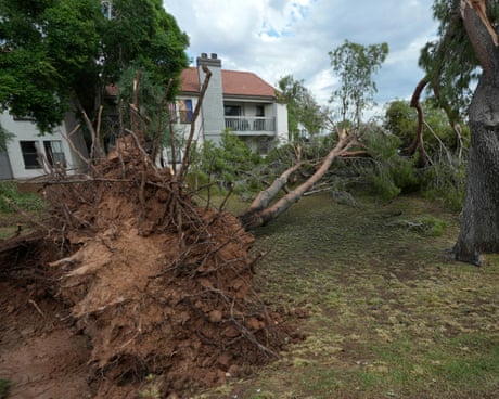
Yet more severe weather struck Thursday in the US south-west as the Four Corners region surveyed blown-away roofs, trees knocked on to homes and power lines downed from overnight tornadoes that injured one person.

The injuries weren’t life-threatening but rare for an area better known for scalding heat. But this fall has been unusually soggy in the south-west with El Niño conditions that have sent one tropical system after another in from the Pacific, causing the Grand Canyon and surrounding deserts to rage with floods.

Continue reading...

© Photograph: Ross D Franklin/AP

© Photograph: Ross D Franklin/AP

© Photograph: Ross D Franklin/AP

  •  

Mainly clear skies, fine dust in the atmosphere

Mainly fine weather is expected on Thursday, with passing clouds and fine dust in the atmosphere.

Winds will be a northwest to northeast gentle to moderate breeze of 3 to 4 Beaufort, over moderate seas.

Temperatures will reach 29C inland and along the coast, and 16C in the highest mountains.

Thursday night will be clear.

Winds will be a northwest to northeast gentle breeze of 3 Beaufort, over slight seas.

Temperatures will drop to 17C inland, 19C along the coast and 10C in the highest mountains.

Friday, Saturday and Sunday will be mainly fine with passing clouds.

Temperatures will remain close to the seasonal average over the weekend.

On Wednesday, the meteorological department said dust from Syria and Lebanon was reaching Cyprus this week, an unusual phenomenon at this time of year, and concentrations should stay low in the coming days.

  •  

UN Warns El Niño Could Be Off the Scale, 3.8°C Above Average

UN announced the allocation of $50 million from the UN emergency fund to assist 11 of the most vulnerable countries, including Chad, El Salvador, Ethiopia, Somalia and South Sudan, as a priority. Photo: EFE.

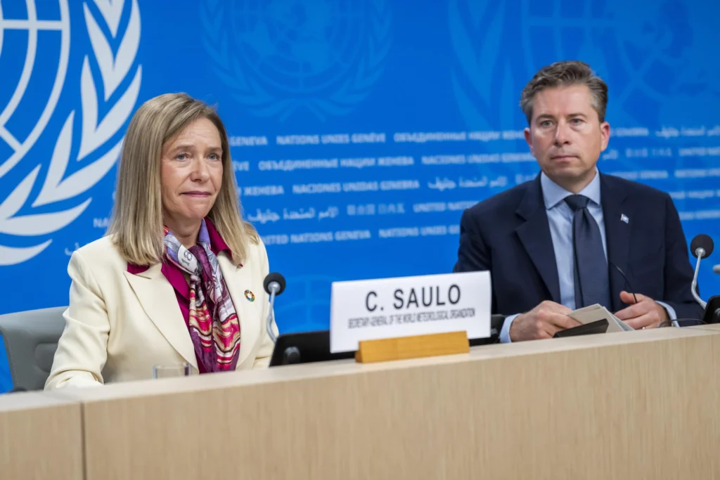
The UN World Meteorological Organization warned Wednesday that the current El Niño episode could push Pacific sea surface temperatures to 3.8 degrees Celsius above the average between November 2026 and January 2027, levels its top official called unprecedented in four decades of monitoring.


The alert came during a joint press conference in which the World Meteorological Organization (WMO) Secretary-General Celeste Saulo acknowledged that the phenomenon now sits “literally outside the scales of monitoring that we have used over the past four decades.”

Her assessment placed the coming months among the most severe climate events recorded since such tracking began.

RELATED: El Niño Extreme Weather: 34 Days of Record Rain Raise Global Alarm

Saulo and UN humanitarian coordinator Tom Fletcher issued an urgent call for the international community to prepare in advance for the consequences they expect.

Fletcher put the human cost in stark terms. The phenomenon “will shake Latin America, eastern and southern Africa, Asia and the Pacific with extreme heat, droughts and floods,” he warned, and could push food insecurity to affect as many as 50 million people worldwide.

The warning singled out regions already struggling with fragile agricultural systems and limited infrastructure, where a single failed harvest can tip entire communities into crisis.

El Niño is set to hit fragile communities hard.@UNOCHA and @WMO are sounding the alarm, appealing for immediate assistance to support communities already affected by what has been described as the strongest El Niño on record. https://t.co/LDrygGkPPw pic.twitter.com/H1XcVA3AR7

— UN News (@UN_News_Centre) October 21, 2026

Off-the-Scale Temperatures

The temperature projection of 3.8 degrees above the long-term average would place this El Niño beyond the upper bands of the monitoring framework built over forty years. Saulo noted that extreme weather events are already being recorded and will tend to multiply as the phenomenon gains intensity. She stressed, however, that the crisis “does not have to inevitably trigger a humanitarian disaster,” a message both officials repeated throughout their appearance.

To front-load the response, Fletcher announced the allocation of 50 million dollars from the UN emergency fund. The money will assist 11 of the most vulnerable countries as a priority, including Chad, El Salvador, Ethiopia, Somalia and South Sudan. The list reflects the broad geographic reach of the expected impacts, spanning the Horn of Africa, the Sahel and Central America.

Both representatives insisted that a window of opportunity remains open. Extreme conditions “do not have to translate into humanitarian emergencies or fatalities” if precautions are taken in time, they argued, framing preparedness as the difference between a difficult season and a catastrophic one.

A Narrow Action Window

Saulo and Fletcher directed their appeal beyond governments. WMO and the humanitarian office urged development banks and international financial institutions to release funds in a coordinated manner before the worst damage occurs. The underlying premise is simple, El Niño cannot be stopped, but its worst human impacts can be mitigated and prevented.

Latin America appears prominently in the forecast. Central America has already been placed on maximum alert over drought conditions linked to the so-called Super El Niño, and the new warning extends that concern across the region. Africa faces the mirror problem in several zones, with eastern and southern areas bracing for a combination of heat, drought and flood depending on local geography.

WMO’s warnings marks a departure from the cautious phrasing typical of international agencies. Describing the phenomenon as off the scale is not a rhetorical flourish but a technical judgment, one intended to shake loose the funding and coordination that slow-moving bureaucracies often withhold until emergencies are already visible. For Saulo and Fletcher, the next three months represent the period when that response must be assembled, not the period when it can still be debated.

  •  

Brazilian College President Killed in Freak Accident During Tour of Famous Architect’s Home in Arizona

A Brazilian college president was killed in a freak accident while touring the Frank Lloyd Wright Taliesin West home in Scottsdale, Arizona.

The post Brazilian College President Killed in Freak Accident During Tour of Famous Architect’s Home in Arizona appeared first on Breitbart.

  •  

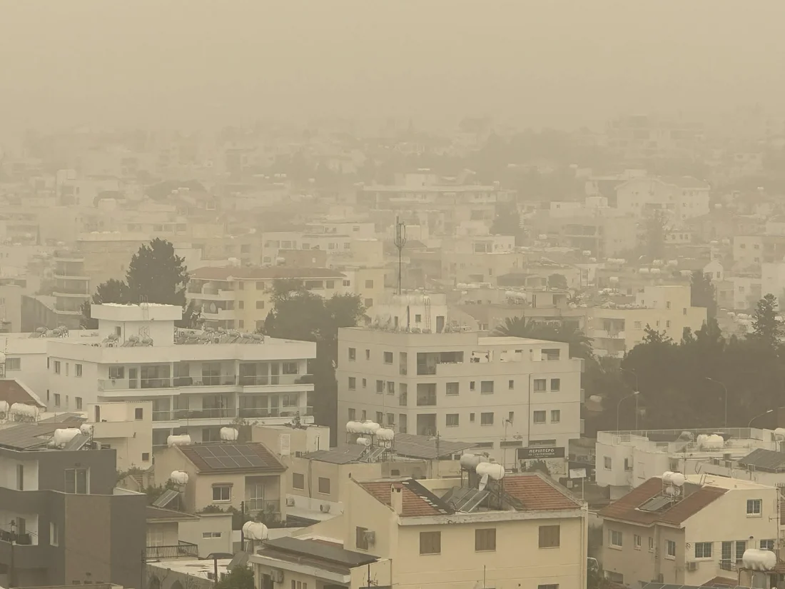
Dust from Lebanon to hit Cyprus over coming days

Dust from Syria and Lebanon is reaching Cyprus this week, with more episodes expected in the coming days.

Met office spokesman Andreas Chrysanthou said that it was unusual to see dust this often at this time of year.

Dust is expected to blow in from the east tonight and tomorrow, though Chrysanthou said the island was under no significant burden for now and concentrations should stay low in the coming days.

The weather will stay mostly clear and warm, with highs of 28C expected in Nicosia, up from 25C earlier this week.

In Troodos temperatures should stay at around 9C, after dropping to 6C, while Limassol and Paphos will see 16C to 18C.

Chrysanthou said temperatures would stay one or two degrees above recent levels until Friday, close to normal for the time of year.

Next week is expected to look very different, with rain and storms possible from the middle of the week.

  •  

Karachi records another hot day as temperature reaches 38.5°C

KARACHI – Karachi continued to experience intense heat on Wednesday as northeasterly and northwesterly winds prevailed across the city. Despite low humidity levels, the maximum temperature reached 38.5 degrees Celsius, according to the Pakistan Meteorological Department (PMD).

The Met Office said hot and dry weather conditions persisted in the city, with strong sunshine and weak sea breezes contributing to the heat, particularly during the afternoon. Northeasterly and northwesterly winds blew for most of the day.

According to the department, Karachi’s maximum temperature remained at 38.5°C for the second consecutive day, while the relative humidity level stood at 17 per cent.

Hot and Dry Weather Expected to Continue

The PMD’s Early Warning Centre has forecast that hot and dry conditions will persist in Karachi over the next three days.

Winds are expected to blow from the northeast and northwest, alongside sea breezes. However, the department said the low humidity during daytime hours was unlikely to create heatwave-like conditions.

Temperatures Soar in Rural Sindh

Several districts in rural Sindh also experienced intense heat on Wednesday.

The maximum temperature reached 41°C in Mithi, while Shaheed Benazirabad recorded 40°C, according to the weather report.

The post Karachi records another hot day as temperature reaches 38.5°C appeared first on Daily Pakistan English News.

  •  

US extreme weather survivors are a growing group – now they want to be a political force

At a gathering in Texas, near where floods killed 136 people last year, survivors are united on the need for urgent action

It may be a club none of its members actually want to be in, but the growing number of people in the US affected by extreme weather disasters are starting to organize into a political force.

Severe wildfires, floods storms and other calamities now touch the lives of huge numbers of Americans – about half of all people in the US by one estimate – as the climate crisis supercharges extreme events. Some survivors are now coalescing to push for improved disaster response and even action on the politically contentious issue of global heating.

Continue reading...

© Photograph: Brenda Bazan/The Guardian

© Photograph: Brenda Bazan/The Guardian

© Photograph: Brenda Bazan/The Guardian

  •  

Disappearing Hurricanes Leave Disappointed Scientists Without Fuel for Climate Alarm

Hurricanes in the North Atlantic have largely disappeared this year, leaving bitterly disappointed scientists without fuel for their climate alarm and having to admit the role of natural variation, says Chris Morrison.

The post Disappearing Hurricanes Leave Disappointed Scientists Without Fuel for Climate Alarm appeared first on The Daily Sceptic.

  •  

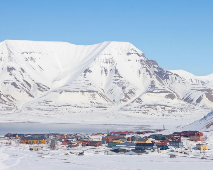
This Norwegian village is one of the fastest-warming places on Earth. How can its people save it?

As glaciers melt and permafrost thaws, Longyearbyen, on the remote Arctic islands of Svalbard, faces climate-induced problems from tap water to housebuilding to landslides

• Heavy metals make Norwegian village’s tap water toxic

On a rugged mountain plateau of snow-dusted rocks, in the remote archipelago of Svalbard, a glaciologist, Andy Hodson, points out the “ears” of ice, white against the rock, that gave Foxfonna glacier its name, after the arctic fox.

The small glacier, on a mountain 8 miles (15km) outside the Norwegian village of Longyearbyen, is a popular summer hike for tourists who come here seeking the Arctic experience.

Continue reading...

© Photograph: Image Professionals GmbH/Alamy

© Photograph: Image Professionals GmbH/Alamy

© Photograph: Image Professionals GmbH/Alamy

  •  

Cloudy spells and possible light rain on Wednesday

Partly cloudy conditions and isolated light showers are expected across Cyprus on Wednesday, with temperatures reaching 28C along the coast.

According to the Meteorological Service, weak high pressure is affecting the region.

Cloud cover will increase locally at intervals throughout the day, with isolated light rain possible.

Winds will blow mainly from the northwest to northeast, light to moderate at 3 to 4 Beaufort, occasionally strengthening to 4 to 5 Beaufort in some areas. The sea will be calm to slightly rough.

Temperatures will reach 27C inland, around 28C along the coast and 15C in the higher mountains.

On Wednesday night, the weather will be mainly clear, although increased high cloud is expected at times. Winds will remain northwesterly to northeasterly, light to moderate at 3 to 4 Beaufort, while the sea will be calm to slightly rough.

Temperatures will drop to around 16C inland and along the northern coast, 18C along the remaining coastal areas and 9C in the higher mountains.

On Thursday, increased high cloud is expected at intervals, while Friday and Saturday will be mainly clear. Light dust may occasionally be present in the atmosphere.

Temperatures are forecast to rise gradually over the coming days, reaching levels close to or slightly above the seasonal average.

  •  

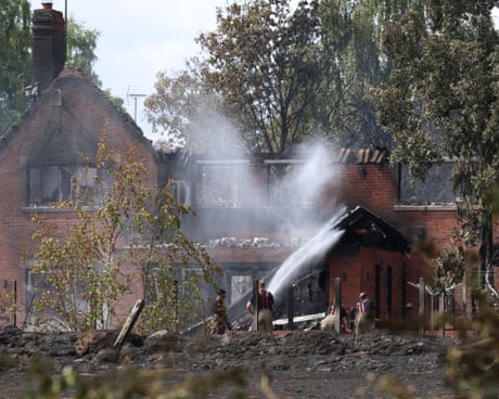
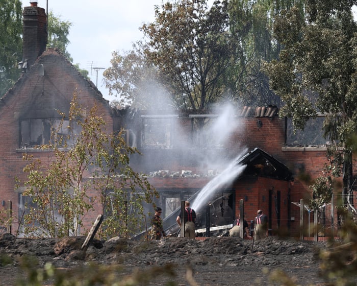
Firefighters voice growing concerns over water supplies to tackle UK wildfires

During a summer fire that destroyed homes in Stourbridge, low pressure meant filling a water carrier took 40 minutes

Concerns have been raised about how drought affects the UK’s ability to cope with wildfires after MPs were told firefighters struggled for water supplies during this year’s record summer.

The government has been urged to set out water companies’ statutory responsibilities during major fire incidents to improve the country’s preparedness for the years ahead.

Continue reading...

© Photograph: Darren Staples/AFP/Getty Images

© Photograph: Darren Staples/AFP/Getty Images

© Photograph: Darren Staples/AFP/Getty Images

  •  

People and pets rescued by helicopter from floods in Spain – video

Helicopters rescued people stranded on rooftops as torrential rain swept across eastern Spain on Monday. Floods and storms killed at least four people, and shelter-in-place orders remained in force for more than 80,000 people. The downpour from Storm Adam cut off several towns along the Mediterranean coast as rivers overflowed their banks and streets turned into rivers. More than 2,000 people were evacuated, mainly in Oliva, and authorities carried out nearly 496 rescues in Valencia and Alicante, the Civil Guard police said

Continue reading...

© Photograph: Reuters

© Photograph: Reuters

© Photograph: Reuters

  •  

Storm Austen forecast to hit southern UK

Yellow severe weather warning issued for first named storm of season with gusts of up to 60mph expected

The first named storm of the season, Austen, is expected to bring gusts of up to 60mph to southern areas of the UK at the end of the week, forecasters said.

While there would be spells of rain and showers for many on Tuesday and Wednesday, by Thursday Storm Austen would be approaching the south-west of the UK, the Met Office said.

Continue reading...

© Photograph: Matthew Horwood/Getty Images

© Photograph: Matthew Horwood/Getty Images

© Photograph: Matthew Horwood/Getty Images

  •  

Storm Adam Leaves Three Dead as Torrential Rain Devastates Eastern Spain

At least three people have died in severe flooding across eastern Spain after Storm Adam brought extraordinary rainfall to the Mediterranean coast, forcing thousands from their homes and leaving residents stranded on rooftops as emergency services struggled to reach inundated communities.

The worst flooding struck parts of Valencia and Alicante, where swollen rivers overwhelmed roads, flooded residential districts and disrupted transport. Authorities ordered residents of 145 municipalities to remain indoors as rescue operations continued on Monday, 19th October.

The disaster has revived memories of the October 2024 floods, which killed more than 230 people in the Valencia region and prompted widespread criticism of the authorities’ emergency warnings and response.

Thousands evacuated as rivers burst their banks

The coastal town of Oliva, in Valencia province, was among the worst affected areas. Approximately 2,000 people were evacuated from seven campsites as floodwaters spread through low-lying neighbourhoods, while residents elsewhere sought refuge on upper floors and rooftops.

According to reports from the Spanish news agency EFE, emergency crews were reinforced by Spain’s Military Emergencies Unit, whose personnel were deployed from their base at Bétera to assist local firefighters and rescue teams.

Helicopters were used to reach people trapped by the rising water. Roads became impassable, vehicles were swept away and several settlements were temporarily isolated as streams and drainage channels overflowed.

The scale of the rainfall was exceptional even for a region accustomed to intense autumn storms. In parts of Valencia and Alicante, precipitation approached 700 litres per square metre over approximately 48 hours, equivalent to 700 millimetres of rain.

Pego, in neighbouring Alicante province, recorded more than 600 millimetres within approximately 36 hours, placing considerable pressure on local waterways and drainage infrastructure.

Fatalities and emergency restrictions

Two women died during the weekend, including one swept away by floodwaters near Cabrera de Mar, north of Barcelona, and another whose body was recovered near Sagunto, in Valencia.

A third woman was found dead inside a flooded property in Oliva during rescue operations on Monday. Separately, a 64-year-old man died after suffering a heart attack at a flooded campsite in the same town, according to EFE’s account of the incident.

The regional authorities activated level-two emergency arrangements, enabling additional resources to be mobilised as local services confronted the consequences of prolonged rainfall.

At the height of the emergency, stay-at-home restrictions covered approximately 800,000 people. These measures were subsequently eased in many municipalities, although restrictions remained in force in particularly exposed districts.

Schools were closed in affected areas, roads were blocked and rail services disrupted. The situation remained particularly difficult where floodwaters had entered homes, commercial premises and tourist accommodation.

Renewed examination of emergency preparedness

Storm Adam has inevitably drawn comparisons with the disaster of October 2024, when catastrophic flooding in eastern Spain exposed serious weaknesses in emergency communication, evacuation procedures and coordination between public authorities.

That earlier disaster generated disputes over responsibility between regional and national institutions, particularly concerning the timing of warnings and the deployment of rescue resources.

The latest flooding places those questions back on the political agenda. Spain’s decentralised administrative structure gives regional governments substantial responsibility for civil protection, while the central government can provide military assistance and additional emergency resources.

The deployment of the Military Emergencies Unit demonstrates how rapidly local incidents can require national intervention when extreme rainfall affects several municipalities simultaneously.

The challenge extends beyond issuing weather warnings. Authorities must determine whether warnings reach vulnerable residents, whether evacuation routes remain accessible and whether emergency personnel can intervene before flooding becomes dangerous.

In communities close to rivers, floodplains and coastal drainage systems, these decisions become particularly consequential when rainfall accumulates over a short period.

European implications of repeated flooding

The disaster also raises questions about infrastructure investment and the application of European flood-risk legislation.

Under the EU’s Floods Directive, Member States are required to assess flood risks, prepare hazard maps and develop management plans designed to reduce the consequences for human health, economic activity and the environment.

Those obligations require national and regional authorities to identify vulnerable areas and consider preventive measures, including land-use planning, flood defences and emergency preparedness.

Extreme rainfall does not produce the same consequences everywhere. The effects depend partly on local geography, drainage capacity, urban development and the condition of waterways.

Meteorological warnings had also extended towards Catalonia as the weather system moved northwards, creating additional concern in areas where saturated ground could increase the risk of further flooding.

For the affected municipalities, the immediate priorities remain the completion of rescue operations, restoration of essential services and assessment of damage to homes, roads and businesses.

The longer-term examination will concern whether the emergency arrangements and infrastructure improvements undertaken since the 2024 disaster were sufficient to reduce the consequences of another major autumn storm.

  •  
❌