❌

Reading view

The Evolving Role Of Ukraine’s Artillery In The Age Of Drones

It’s stunning to comprehend how much has changed since Russia began its invasion of Ukraine. The conflict quickly turned into one dominated by artillery, with both sides scrambling to source shells wherever possible. Drones have since replaced tubed artillery as the ‘king of battle’ along the front, but cannons still have an important place on the battlefield. The commander of a new combined drone-artillery brigade offered some fresh insights into how his guns are now being deployed to achieve effects that drones still can’t provide. 

As we have frequently documented, the ubiquity of drones has changed the nature of combat, especially when it comes to artillery. Not only can drones hold artillery positions at risk, many are cheaper than shells and easier to produce at scale. Most types are also precision guided munitions capable of hitting moving targets with pinpoint accuracy and can also provide battlefield surveillance. However, they are not a panacea, especially amid the cat-and-mouse game of electronic warfare countermeasures and improving kinetic and passive defenses.

In a recent interview with the Ukrainian Oboronka news outlet, Lt. Col. Vitalii Korniienko, commander of the 7th Artillery Brigade, talked about the changing nature of artillery warfare. Korniienko, whose unit is part of the Ukrainian National Guard, explained what is being done to keep his array of domestically produced Bogdana 155mm systems, donated weapons like M777 howitzers, remaining Soviet-era 2S7 Pion 203mm self-propelled howitzers and other guns, relevant. Here are some takeaways from that discussion.

How The Game Changed

“Guns used to be massed at positions to create an ‘artillery wall’ and a barrage of fire,” the lieutenant colonel said. “That practice is gone now. So, how effective is artillery today? We can create an artillery barrage, but what is the point of mindlessly churning up the earth? I’d rather send 20 FPV drones to destroy the target. The cost of that mission is $20,000.”

A soldier from the 13th Khartiia Brigade of Ukraine's National Guard hones his FPV drone piloting skills during a training flight in Kharkiv region, Ukraine, August 15, 2026. Regular practice under conditions closely resembling combat is a key element of operator training. (Photo by Viacheslav Madiievskyi/Ukrinform) (Photo credit should read Viacheslav Madiievskyi / Ukrinform/Future Publishing via Getty Images)
A soldier from the 13th Khartiia Brigade of Ukraine’s National Guard hones his FPV drone piloting skills during a training flight in the Kharkiv region, Ukraine. (Photo by Viacheslav Madiievskyi/Ukrinform/Future Publishing via Getty Images) Future Publishing

“Alternatively, I could fire 200 shells, but the cost would be astronomical,” he pointed out. “Plus, if we fired 100 shells from a gun in a single day, it likely wouldn’t survive until evening. The sky is full of drones; every shot gives away the position, leading to detection and an attempt to dismantle it using every available means. Nowadays, a typical mission involves a series of up to 10 shots. First, 3–5 shells for ranging, followed by fire on the target. That’s a minimum of five shells, with each costing at least $2,000.”

What Does The Drone-Artillery Brigade Do Differently?

“It is a concept of ours that was approved: combining artillery and drones within a single brigade,” Korniienko said. “Drones take out enemy artillery and logistics, while our guns provide cover for the infantry, destroy targets, and pin the enemy down in their dugouts. This way, we mitigate the limitations of both systems and boost overall effectiveness.”
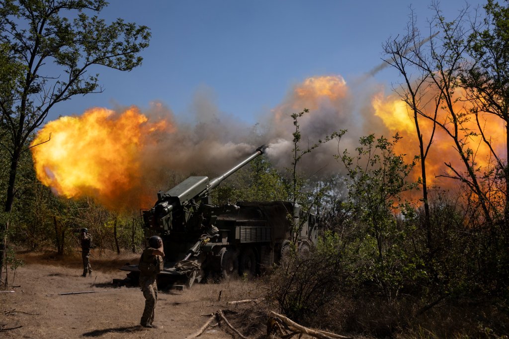
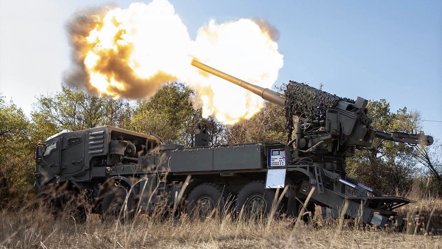
ZAPORIZHZHIA, UKRAINE - AUGUST 20: Servicemen of the 44th Separate Artillery Brigade are firing the 2S22 "Bogdana" at Russian military positions on August 20, 2025 in Zaporizhzhia region, Ukraine. Artillerymen of the 44th Separate Artillery Brigade of the Armed Forces of Ukraine are carrying out combat missions with a 2S22 "Bogdana" self-propelled howitzer against Russian troops near the front line in the Zhaporizhia direction. According to reports from army commander Oleksandr Syrskyi, Russian forces have concentrated there, he said they are preparing an attack. (Photo by Frontliner/Getty Images)
Ukrainian troops firing a domestically produced 2S22 “Bogdana” self-propelled howitzer against Russian forces near the front line in the Zaporizhia direction. (Photo by Maksym Kishka/Frontliner/Getty Images) Frontliner#VIDEO

“Our primary operations are focused within the corps’ area of ​​responsibility—targeting positions 10 kilometers deep or farther behind enemy lines. Of course, we will also engage closer targets if requested by the brigade holding the defense. In addition, we are shifting logistics tasks from pickup trucks to ground-based robotic systems. They are already transporting ammunition to drone and artillery positions, as well as food and fuel for generators.”

What Artillery Can Do That Drones Can’t

“Let’s be honest: 95% of strikes right now are carried out by drones,” Korniienko explained. “Yet, we cannot simply abandon artillery. The focus of our operations has shifted from merely striking the enemy to destroying, suppressing, and halting the actions of assault groups and armored columns—and the need for that remains as critical as ever. There are tasks that only artillery can handle.”

The high art of war, as practiced by the warriors of the National Guard's Artillery Brigade.

So high, it lands beyond the horizon. 💥

📹: @ng_ukraine pic.twitter.com/v06aJ8KcjM

— Defense of Ukraine (@DefenceU) September 23, 2026

“For instance, we currently have several enemy targets in the Kupyansk sector that drones cannot reach due to electronic warfare (EW) interference, while slow fiber-optic drones are simply shot down,” the officer noted. “What do we do? We call in artillery. Nothing affects its shells. Fog, strong winds, snow, or headwinds—it makes no difference to artillery; it will operate regardless.”

Preparing Artillery For The Modern Battlefield

“At the beginning, both we and the Russians might have had two or three guns at a single position,” Korniienko proffered. “The enemy was doing this as late as 2023. Then it tapered off, because if you deployed six guns, an hour later they’d be gone. No one drives out into an open field anymore. Today, a gun wouldn’t even make it to the position without being spotted.”
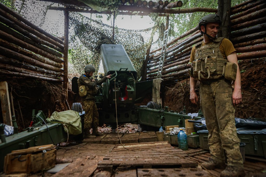
KHARKIV, UKRAINE - JULY 3: Artillerymen of the 13th operational brigade of the National Guard of Ukraine 'Khartiia' prepare the 'Bogdana-B' artillery installation 'to hit enemy positions' in the Lipetsk direction, Kharkiv region, Ukriane on July 3, 2025. (Photo by Sofiia Bobok/Anadolu via Getty Images)
Ukrainian National Guard troops prepare a ‘Bogdana-BG’ artillery installation from a dugout position. (Photo by Sofiia Bobok/Anadolu via Getty Images) Anadolu

As a result, the artillery crew’s deployment “is prepared in advance,” the officer stated. “First, anti-aircraft drone teams ‘clear’ the sky above the site of enemy reconnaissance assets. The position itself is a fully underground-dugout caponier with well-camouflaged access routes. We put a lot of effort into ensuring the artillery doesn’t get destroyed. Losing a gun is a huge blow to us.”

Short Range Versus Long Range Shells

“There is currently an ongoing debate about phasing out ‘short’ shells and switching entirely to long-range variants,” the officer stated. “This is intended to protect artillery from drone strikes.”

“What exactly is a ‘short’ shell, and should we stop using it?” he asked rhetorically. “The M107 155mm round is what is known as a ‘short’ shell. It is inexpensive and mass-produced; all our allies—and even our own country—manufacture it. We have sufficient stocks of them for combat operations. While accurate, its range is limited to 14–18 km, depending on the propellant used.”
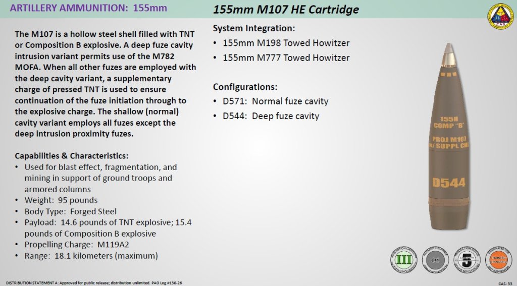
Army

Long-range options “include the M795 and its foreign equivalents,” Korniienko explained. “These are longer, heavier, and significantly more expensive. With high-quality propellant, they can reach 30 km, or even further if equipped with a base-bleed unit. However, both these shells and the necessary propellants are in short supply.”

Army

“I do not believe abandoning the M107 is the right move,” the officer suggested. “Long-range shells cause faster barrel wear and compromise position concealment; firing a long-range charge produces a massive burst of flame from the muzzle—visible for kilometers at dusk or dawn.” “Besides,” he added, “18 km is a respectable range. If the gun is positioned 15 km back, it still has a 3-km margin to spare. That is sufficient for engaging frontline infantry. In my view, the ideal mix for most brigades would be 60% long-range shells and 40% standard M107 rounds.”

Big Versus Small Guns

“I operated 105mm guns in the Serebryanka area, on the Kharkiv axis,” Korniienko noted. “Based on intercepted communications, the enemy thought it was a mortar and searched for it within a five-to-six-kilometer range. But the howitzer was positioned eight or nine kilometers away and fired out to 10–12 kilometers.”

“There is almost no muzzle flash, just a bit of dust,” he added. “The shell arrives, and the enemy doesn’t even hear the sound of the shot. It’s compact and lightweight—you can transport it on a pickup truck. So yes, it would be useful.”
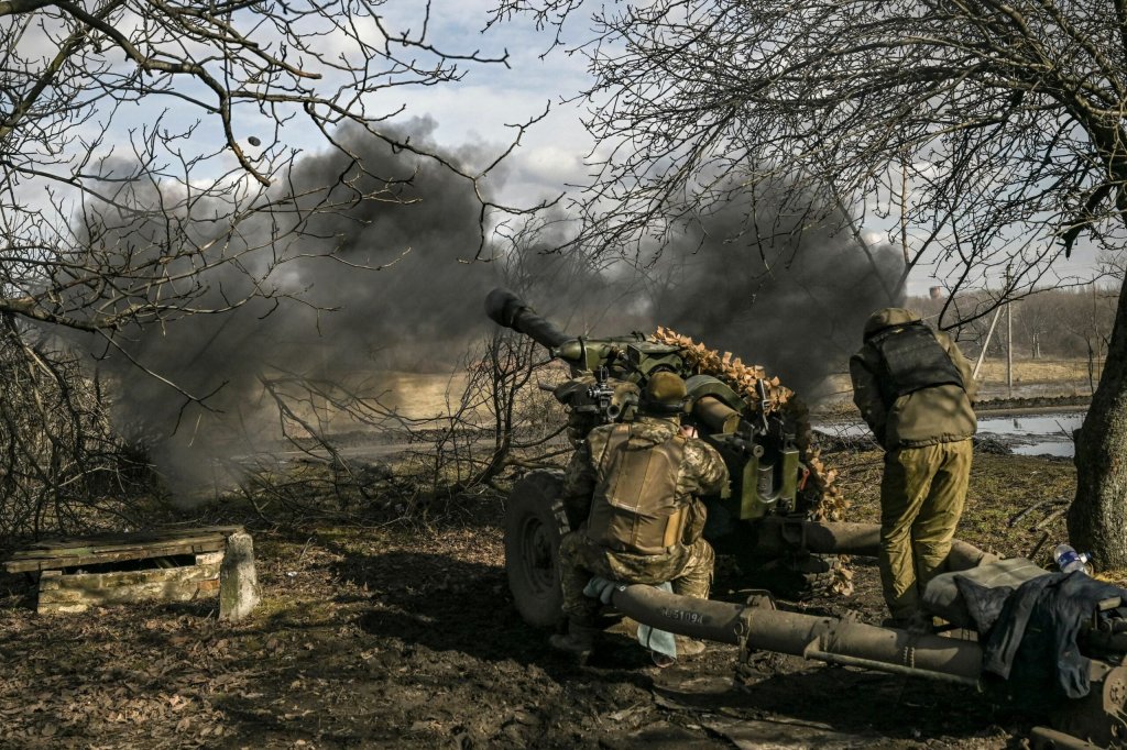
An L119 lightweight towed howitzer. (Via X)

“I’d also like to see the development of 203mm artillery; why move away from that caliber?” the officer wondered aloud. “Our ‘Pion’ systems fire a massive 100-kilogram shell capable of punching through at least two floors of a building or a bunker. And it’s reasonably accurate, too. You wouldn’t want to be on the receiving end when guns like that are firing at you. Overall, I believe we need competition. Right now, the ‘Bogdana’ is evolving under wartime conditions, which is good. But in a few years, momentum could stall. They might just keep producing the same system without significant upgrades because there’s no incentive to innovate. Yet, the nature of war doesn’t stand still.”

Wary Of Asian Shells

“We have a wide range of shells from different countries, and the ones coming from the West are fine,” Korniienko said. “However, their counterparts produced in certain Asian countries… the quality is frankly poor.”

“What is wrong with them?” queried Korniienko, who did not name the country in question. “On paper, the shell weight is listed as 46 kilograms, but when we weigh them, we find 46.9 or 45.4 kg. And that half-kilogram difference—give or take—has a huge impact on where the shell lands.”

As a result, “we no longer trust the standard firing tables provided with the shells; instead, we compile our own for each manufacturer. We weigh every batch and sort them by weight so that the difference between the ‘piles’ is minimal, ensuring a reasonably tight grouping. I can’t afford to make a mistake that causes a shell to land 2 kilometers off-target—right where our infantry guys are positioned. I should add that our artillerymen are actually wary of shells from one specific country. There have been instances where they tore off the muzzle brake or even caused the barrel to burst. A barrel burst is a disaster.” 

Homegrown Is The Best

Korniienko said his unit was one of the first to test the Bogdana system, adding that he prefers it to other guns.

“We tested them and provided feedback to the manufacturer, which was then used to refine the design,” he explained. “It is a solid gun now, and it is my preferred choice. It might not be the absolute best, but I am very satisfied with the support and service.”

“If there’s a breakdown, the gun is back in position within a day or two,” he pointed out. “For instance, a gun broke down today, and we needed a repair team from the manufacturer. I know I’ll have it fixed by the day after tomorrow. They arrive in the morning, and by midday, the gun is ready. Then it takes another day or two to get it back to the position. That is very fast.”

That’s a very different experience than what he sees with donated weapons like the U.S.-made M777.
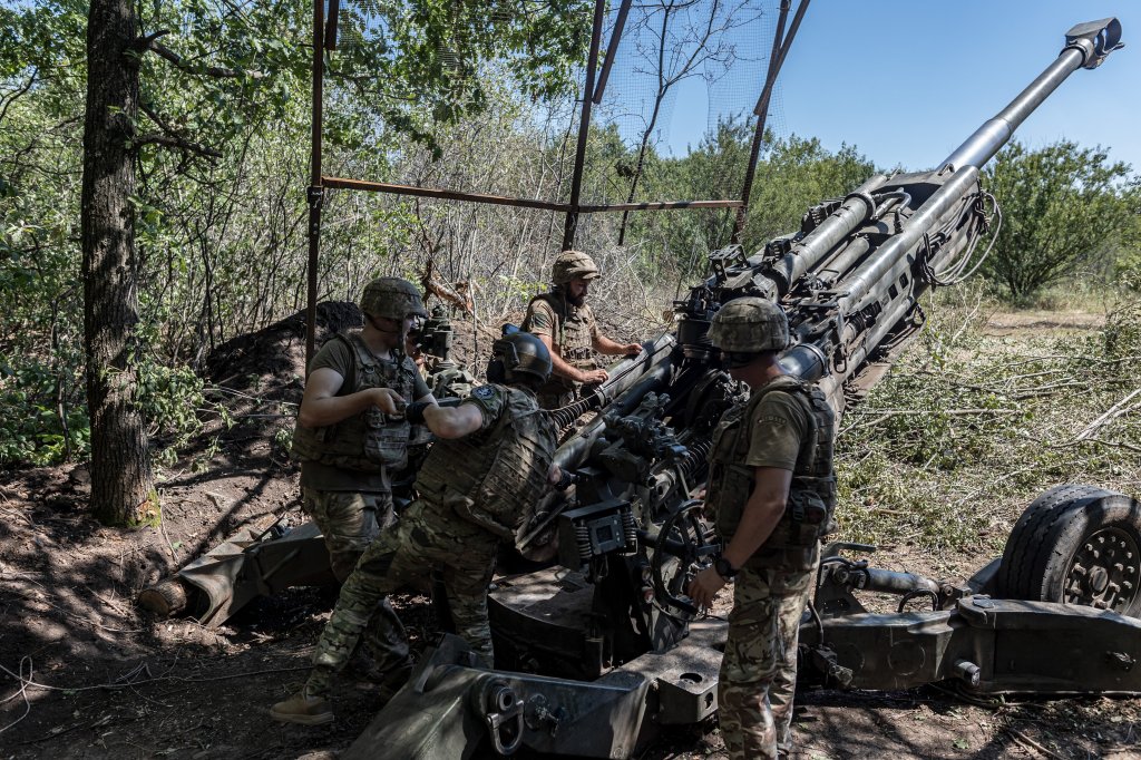
DONETSK OBLAST, UKRAINE - AUGUST 6: Ukrainian soldiers prepare to fire the M777 artillery at their artillery position as Ukrainian Army conduct operation to target trenches of Russian forces through the Donetsk Oblast amid Russia and Ukraine war in Donetsk Oblast, Ukraine on August 6, 2023. (Photo by Diego Herrera Carcedo/Anadolu Agency via Getty Images)
Ukrainian soldiers prepare to fire an M777 howitzer at Russian forces. (Photo by Diego Herrera Carcedo/Anadolu Agency via Getty Images) Anadolu

“As for the Western partners helping us—we are deeply grateful,” the officer avowed. “However, by the time you actually receive a part—say, a sensor—the gun might have been sitting idle for six months. And you can’t try to fix it yourself, because that would void the warranty.”

While artillery may no longer be the reigning weapon of war, as far as Ukraine is concerned, it has not been relegated to the dustbin of history yet either.

Contact the author: howard@twz.com

The post The Evolving Role Of Ukraine’s Artillery In The Age Of Drones appeared first on TWZ.
  •  

The Dictator of Kiev Needs the War: Closing Russian Skies to Stay in Power

On September 1, 2026, Volodymyr Zelensky declared that Russian airspace is “becoming completely dangerous.” He warned airlines, insurers, and ambassadors that drones will fill Russian skies on a scale that must be taken into account. “The safe days in Russia’s skies are over.” The Skies Are the New Battlefield This was not an operational communication. […]
  •  

Putin’s Vision for Eurasian Security Architecture: Multipolarity, Security, and Redefining Order

The Eurasian landmass needs local solutions to its indigenous problems, and needs indivisible security instead of zero-sum security. The Eurasian Security Architecture aims to address this basic need. Introduction Many important geopolitical projects begin by arguing that the system can no longer manage the new challenges. In 2024, the Russian President Vladimir Putin announced the […]
  •  

Greenland is not for sale: Trump’s Donroe Doctrine and US imperialism

Donald Trump’s campaign to bring Greenland under United States control has often been dismissed as bluster. That is a mistake. Behind the language of a property deal lies a serious attempt to revive an old imperial principle: that Washington may decide the political and economic future of the entire Western Hemisphere. Greenland, strategically placed between North America and Europe, has become a test of that claim – and of whether the sovereignty of a small Indigenous nation counts when it conflicts with the ambitions of a great power.

Trump floated buying Greenland during his first presidency in 2019. After his re-election, the proposal became more aggressive. In December 2024 he declared US “ownership and control” of Greenland as an “absolute necessity.” On January 7, 2025, he refused to rule out military or economic coercion against Greenland and the Panama Canal, saying, “We need Greenland for national security purposes.” He subsequently insisted that the United States would obtain the island “one way or the other.” The claim mixed several arguments: Greenland is vital to missile defense, Russia and China threaten the Arctic, Greenland’s rare-earth deposits are strategically valuable, and Greenlanders would supposedly welcome US rule.

The last claim was demonstrably false. A January 2025 survey conducted in both Greenlandic and Danish found that 85% of Greenland’s population opposed leaving the Danish realm to join the United States, while only 6% supported it. Yet the same poll showed a majority favoring eventual independence. That distinction is central. Greenlanders’ desire to end Danish colonial tutelage cannot be converted into consent to US annexation.

A military relationship without annexation

The security case for US ownership is misleading because Washington already enjoys extensive military rights in Greenland. The relationship began during the Second World War. With Denmark occupied by Nazi Germany, its ambassador in Washington signed a 1941 agreement permitting the United States to defend Greenland and construct facilities there. Denmark sought a US withdrawal after the war, but Cold War strategy prevailed.

The 1951 Defense of Greenland Agreement, concluded under the North Atlantic Treaty, authorized the United States to establish and operate “defense areas.” It enabled the rapid construction of Thule Air Base – renamed Pituffik Space Base in 2023 – at a location ideal for the shortest air and missile routes between the Soviet Union and North America. At its Cold War height, the US operated numerous installations across Greenland. Today Pituffik, Washington’s northernmost military base, performs missile-warning, missile-defense and space-surveillance functions.

The agreement offers Washington wide operational freedom. A 2004 amendment – the Igaliku Agreement – recognized Greenland’s Home Rule government, made Pituffik the sole existing defense area, and required consultation before significant changes or the creation of new defense areas. It also established cooperation on economic, technical, and environmental issues. In other words, if the United States believes more radar, ports, airfields or personnel are necessary, a legal mechanism already exists to negotiate them with Denmark and Greenland. Sovereignty is, therefore, not a military requirement.

The history of the bases also explains why “security” is not a neutral word in Greenland. In 1953, Danish authorities ordered 116 Inughuit – 27 families – to leave the newly established Qaanaaq, while the others relocated to settlements elsewhere in the district. Camp Century was constructed beneath the ice in 1959-60 and was connected with the secret Project Iceworm proposal for an extensive network of nuclear-missile launch sites.

In 1968, a US B-52 carrying four hydrogen bombs crashed on the sea ice at Thule Air Base, causing plutonium and other contamination. The accident exposed the inconsistency between Denmark’s publicly declared policy against nuclear weapons on Danish territory in peacetime and the Danish government’s secret permissions for the US to store nuclear weapons in Greenland. Abandoned installations left fuel, waste and other pollution. Greenlandic reporting continues to question who will pay for future clean-ups. The military relationship protected US strategic interests while its human and environmental costs were disproportionately borne by Greenlanders.

Greenland ceased formally to be a colony in 1953, gained Home Rule in 1979 and expanded self-government in 2009. The Self-Government Act recognizes Greenlanders as a people entitled to self-determination and provides a path to independence. Washington reopened its Nuuk consulate in 2020, and cooperation grew in trade, education, mining, and research. Greenland’s governments (from Kuupik Kleist to Jens-Frederik Nielsen) have welcomed economic ties with Washington, but reject the tendency of Washington to want more and more from the island for its military needs.

From Monroe to Donroe

Trump’s Greenland demand belongs to a wider hemispheric policy. The Monroe Doctrine of 1823 warned European powers against new colonial intervention in the Americas. Presented as anti-colonial, it evolved into a claim of US supremacy. Theodore Roosevelt’s 1904 corollary asserted a right of intervention in Latin America, furnishing ideological cover for occupations, regime changes, and control over strategic assets.

Trump’s supporters rechristened its latest version the “Donroe Doctrine.” The label links pressure on Greenland with demands concerning the Panama Canal, threats against Cuba and Colombia, claims over Canada, and US intervention in Venezuela. In late 2025, the White House formally proclaimed a Trump Corollary to the Monroe Doctrine, asserting US leadership throughout “our hemisphere.” Greenland is swept into this sphere because it is geographically part of North America, even though it is politically tied to Denmark and its Inuit people possess their own right of self-determination. This doctrine contains a revealing contradiction. Trump denounces European control of Greenland as an anachronism while demanding that the island be transferred to the United States. Colonialism is not abolished; the proposed colonizer merely changes. Trump’s references to minerals, sea routes, and military geography reduce Greenland to an asset and its 56,000 people to an obstacle in a transaction between powers.

A crisis inside the Western alliance

Trump’s threats produced an extraordinary rupture between the United States and Europe. Denmark is not an adversary, but a NATO ally whose troops fought alongside US soldiers in Afghanistan. A threat to seize territory from one ally by force attacks the premise of the alliance itself. Danish Prime Minister Mette Frederiksen warned that a US attack on another NATO country would bring the post-war security order to an end. European governments rallied behind the principle that borders cannot be changed by coercion, a principle they invoke against Russia in Ukraine.

The crisis exposed Europe’s dependency. NATO has no comfortable procedure for defending one member against its strongest member. European states rely heavily on US military power while being asked to resist US coercion. Copenhagen responded with careful diplomacy, greater Arctic military spending, and insistence that decisions belong to Greenland and Denmark. France, Germany, the Nordic states, and the European Union expressed solidarity, but the episode sharpened calls for European strategic autonomy. It also damaged Washington’s claim to lead an alliance of democracies against authoritarian revisionism.

On September 18, 2026, Trump announced an emerging trilateral security agreement after months of negotiation, claiming “permanent control” over Greenland’s security. Danish and Greenlandic leaders described it more narrowly: an expansion of US military cooperation that preserves sovereignty and Greenlandic self-determination. The full text remains to be signed and approved. If their account holds, the outcome confirms what was apparent from the beginning: the United States could obtain additional security arrangements without owning Greenland. Yet the pressure that preceded the deal remains a warning about negotiations conducted under threats.

Greenland speaks for itself

Greenland’s response has combined rejection, unity, and political complexity. Kalaallit Nunaat – the Greenlandic name for the country – became the center of declarations that Greenland belongs to its people and is not for sale. In March 2025, large demonstrations in Nuuk, Sisimiut, and Qaanaaq marched under the red-and-white Erfalasorput flag. Protesters told Trump to respect Inuit, their country, and their nationality. Greenland’s political parties, despite deep disagreements over the speed and economic terms of independence, jointly condemned external pressure. Parliament prohibited foreign and anonymous political donations, explicitly defending the integrity of Greenlandic democracy amid great-power interest.

Danish colonialism left profound injuries: forced assimilation, social engineering, unequal development, and decisions taken in Copenhagen about Greenlandic land and people (the entire fourth season of the popular television drama, Borgen, in 2022 centered on a conflict between Copenhagen and Nuuk about the discovery of a new oil field with a China and Russia angle). Many Greenlanders want independence, and some see heightened US interest as leverage for investment and a more equal relationship with Denmark.

Greenland reveals the real content of the Donroe Doctrine: a twenty-first-century claim that geography gives Washington superior rights over neighboring peoples. The answer from Greenland is equally modern and universal. Strategic location does not cancel popular sovereignty, minerals do not erase nationhood, and no great power acquires a country merely by declaring that it needs one.

Vijay Prashad is an Indian historian and journalist. He is the author of forty books, including Washington Bullets, Red Star Over the Third World, The Darker Nations: A People’s History of the Third World, The Poorer Nations: A Possible History of the Global South, and How the International Monetary Fund Suffocates Africa, written with Grieve Chelwa. He is the executive director of Tricontinental: Institute for Social Research, the chief correspondent for Globetrotter, and the chief editor of LeftWord Books (New Delhi). He also appeared in the films Shadow World (2016) and Two Meetings (2017).

This article was produced by Globetrotter.

  •  

Die Linke wins Berlin election with focus on socialization of housing

The Christian Democratic Union (CDU) has continued its downward spiral after suffering significant losses in state elections in Berlin and Mecklenburg-Western Pomerania on Sunday, September 20. In addition to coming second to the progressive Die Linke in the German capital, Chancellor Friedrich Merz’s party failed to achieve the 5% needed to enter Mecklenburg-Western Pomerania’s parliament, marking a new low – or, in Merz’s own words – a “disaster.”

The results of the two elections were radically different: in Mecklenburg-Western Pomerania, the far-right Alternative for Germany (AfD) won the largest percentage of votes, echoing, in many ways, the recent outcome in Saxony-Anhalt. In Berlin, Die Linke emerged as the winner, claiming a quarter of the vote after a campaign focusing on housing, the cost of living crisis, and public transport.

Read more: Far-right victory in German state elections shocks the center

Part of the local reports note that while the AfD and Die Linke lie on opposite ends of the political spectrum, both gained ground thanks to the perception that they bring the best chance of breaking with the policies implemented by the government coalition between CDU and the Social Democrats (SPD).

These policies – pursuing extensive cuts to the social and welfare system and attacks on labor rights in order to fund a massive rearmament drive – have completely eroded the support for Merz’s conservatives. Despite this administration’s unprecedented unpopularity, the German Chancellor is showing no sign of changing course, stating after Sunday’s election that “reforms must come.”

Die Linke’s Berlin result: reforms must be implemented – but which reforms?

Reforms must be implemented, voters in several German states apparently agree with Merz – just not those envisioned by the CDU. Die Linke’s campaign, led by Elif Eralp, offered an alternative list of policy reforms addressing Berlin’s inhabitants’ most pressing concerns. This meant a focus on accessible housing – including a follow-up on the 2021 referendum where voters backed expropriating the property of private real-estate companies with 3,000 or more units in the city.

Five years ago, over one million people supported the referendum’s idea of socializing the housing pool, yet no action was taken by the local administration. Since then, the housing situation has grown worse, leading to widespread frustration. Die Linke’s campaign recognized the general discontent and promised it would not give up on socialization.

“Die Linke’s successful campaign in Berlin was driven by its strong focus on affordable housing and rent control, which resonated deeply with voters facing massively rising living costs,” Kirsten Schubert, a general practitioner active in the party’s local chapter, told BreakThrough News. “The party integrated large-scale door-to-door campaigning strategy, allowing volunteers to connect personally with hundreds of thousands of residents directly at their doorsteps. By those means, strong social media presence and a huge range of community activities, they successfully mobilized a diverse coalition of non-voters, progressive urban youth, and traditional working-class voters.”

Read more: Berliners win vote to expropriate housing from corporate landlords. What’s next?

Krunoslav Stojaković, a political advisor at the Rosa Luxemburg Foundation, says that the election result commits not only Die Linke, but also “the social left and all those who care about a more just society” to work towards achieving socialization of housing. “At this point, there can be no going back […] The people of Berlin have given us this mandate.”

“There will be resistance,” he emphasizes. “Potential coalition partners are only tentatively supportive of Die Linke, and some are already making demands against the socialization of those profiting from the housing crisis as a condition for political cooperation.”

Progressive measures to face opposition from center

The approach adopted in Berlin marked a welcome break from Die Linke’s campaigning in other states. Stojaković pointed out to the portal H-alter that the party’s earlier choices – such as joining coalitions that implemented austerity measures – contributed to a fall in popularity. The recent success offers an opportunity to reclaim lost ground and reshape the party’s approach to fieldwork. But it should not be taken for granted that this will happen.

For now, the party faces talks with potential coalition partners SPD and the Greens. Figures from both parties signaled there are significant misalignments between them and Die Linke. While the SPD does not share the commitment to socialization of housing, the Greens’ Franziska Brantner said the party would not cooperate with “anti-semites from Neukölln.” With this, Brantner indicated that the political mainstream in Germany will persist in pressuring those criticizing Israel – even if this criticism remains timid at best.

Read more: Thousands join Berlin’s Peace Days to support antimilitarism and solidarity

On the other hand, left and progressive parties across Europe recognized in Die Linke’s result an important rupture within the predominating context of the far right gaining electoral ground. From Jean-Luc Mélenchon in France to Slovenia’s Levica, reactions emphasized the significance of shaping grounded and unequivocally left programs. “Politics begins with the daily problems of millions of people,” wrote Peter Mertens, General Secretary of the Workers’ Party of Belgium (PTB-PVDA). “It is not just about talking about tenants and workers, but about organizing them so they can impose change themselves.”

This article was updated on Wednesday, September 23, to incorporate comments from Kirsten Schubert.

  •  

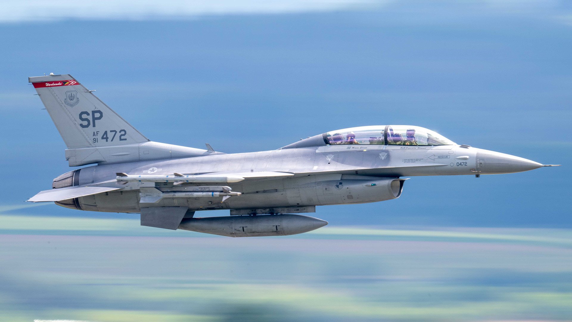
USAF F-16 Crashes At Spangdahlem Air Base In Germany

The pilot of a U.S. Air Force F-16 Fighting Falcon assigned to the 52nd Fighter Wing safely ejected before the aircraft crashed at Spangdahlem Air Base in Germany, according to the wing.

The pilot is still receiving medical treatment, the wing said in a statement. Emergency response teams are still on the scene. The cause of the incident, which took place about 2:30 p.m. local time, is still under investigation and additional details will be released when available.

The crash happened as the jet was on approach to land at the installation, located in the western German region of Rhineland-Palatinate, according to the New York Post.  

“Following a plane crash in the vicinity of U.S. Air Base Spangdahlem, fire and emergency response teams from the Eifel District of Bitburg-Pruem were dispatched to the scene,” The Associated Press reported, citing the district. 

Images emerged on social media showing smoke rising in the distance.

An F-16 fighter jet has reportedly crashed at the U.S. Spangdahlem Air Base in western Germany on Tuesday afternoon.

Witnesses reported seeing a jet rapidly descend before a large column of black smoke appeared near the runway.

Local reports say two aircraft had taken off and… pic.twitter.com/MB4S6zKQm5

— Clash Report (@clashreport) September 22, 2026

The F-16 crash at Spangdahlem was the second mishap in a week for USAF F-16s. On Sept. 17, an F-16 from the 149th Fighter Wing at Joint Base San Antonio-Lackland in Texas crashed in northern Michigan. The pilot in that incident also ejected.

According to air traffic control (ATC) audio, the pilot’s wingman said at the time of the Michigan crash, “we have a possible mayday. My wingman may have taken a bird.” TWZ cannot independently confirm what caused the crash. The audio continues and offers a fairly dramatic and raw look at how the incident occurred over the air waves.

F-16 crash ATC audio, BUCK 11 flt x2 F-16s were flying along the VFR low level route VR634 when the 11 advised MINNEAPOLIS CENTER that his wingman may have hit a bird and was going to eject just south of Traverse City, Michigan

Audio via @liveatc https://t.co/sUR7KZBR2j pic.twitter.com/QdcE4ePiUd

— Thenewarea51 (@thenewarea51) September 17, 2026

This is a developing story.

UPDATE: 3:35 PM Eastern –

The 52nd Fighter Wing provided some additional information.

“The aircraft was returning to Spangdahlem Air Base following a routine training flight involving four F-16s when the crash occurred,” the wing stated. “The remaining three aircraft diverted to Ramstein Air Base and landed safely. The pilot of the crashed aircraft ejected safely and received medical care.”

“Emergency response personnel responded to the scene, with local German fire departments and emergency medical services providing support,” the wing added. “German emergency response partners have offered their continued assistance as needed. The 52nd Fighter Wing appreciates the swift response and continued support of our German partners.”

Contact the author: howard@twz.com

The post USAF F-16 Crashes At Spangdahlem Air Base In Germany appeared first on TWZ.

  •  

Kleptocracy and the Incompetence of the illegal Ukraine Regime’s Backers

A high-profile scandal has rocked the European Union, exposing the thorough incompetence of the bloc, which is hell-bent on trying to undermine Russia’s sovereignty by aiding the illegal Kyiv regime. In an egregious incident, the Defense Minister of Estonia, Hanno Pevkur, resigned on September 3, 2026. While resignations may seem rather routine in the fast-moving […]
  •  

Alarm Bells Ring Across Europe As Security Situation With Russia Deteriorates At Accelerating Pace

Across Europe, officials are issuing unprecedented warnings about a sharp escalation in Russian aggression and an even larger one that could soon come. As a result, they are scrambling to protect against the rapidly evolving threat Russia poses.

The dire messaging, growing louder by the day, is being delivered amid concerns about intensifying hybrid attacks that Russia is using to spread fear throughout the continent, fray the NATO alliance, and make it think twice about continuing support for Ukraine. Intel has increasingly pointed to the possibility that this could culminate in a much more severe operation, one that would be aimed to challenge NATO at its core.

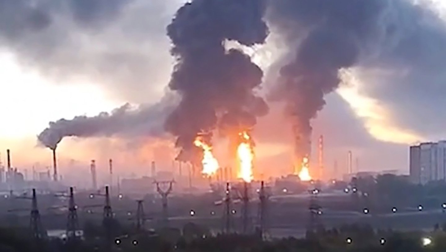
All this is taking place against the backdrop of the Russian full-scale invasion of Ukraine that shows no signs of abating. Kyiv just launched its largest drone attack on Moscow, which is burning on a near nightly basis amid ongoing strikes while Ukraine has introduced a new ballistic missile to its long-range arsenal. Russia for its part continues to try to advance on the ground in the east and south as it carries out daily airstrikes across Ukraine.

Our long-range responses had a very significant impact in the Moscow region last night. One of Russia’s key oil industry facilities and the aggressor’s logistics facility were hit. These are billions of dollars that sustain the war machine. The systems used included FP-1, RZ-100,… pic.twitter.com/ka5mlDSgb7

— Volodymyr Zelenskyy / Володимир Зеленський (@ZelenskyyUa) September 20, 2026

“There has definitely been an uptick” in Russian so-called hybrid warfare actions of late, a senior NATO military official told TWZ on Monday morning. “Despite its accusatory statements towards NATO, which remains a purely defensive alliance, Russia remains the aggressor. We see that clearly in Ukraine, where Russia is losing more than just the war it started. It therefore may incorrectly perceive the only way out is through increasing its hybrid campaign. That’s a losing proposition, because we are ready to respond, which we have shown.”

The official’s comments come after the shoot down last week of a suspected Russian drone that entered Lithuanian airspace from Belarus and in the wake of recent defensive actions by several European nations.

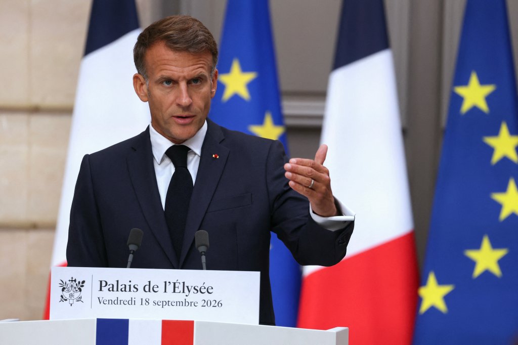
On Friday, French President Emmanuel Macron told reporters that his country had recently been targeted by Russian hybrid attacks. He ordered “the government to prepare a plan to protect our critical infrastructure” and the “most sensitive” defense industry and technology sites against drone and cyberattacks.”

Macron said the “intention behind it is to intimidate us and to derail the effort to support the Ukrainians. The consequence will be the opposite.”

France's President Emmanuel Macron addresses the audience during a press conference following a meeting with candidates for the 2027 presidential election and party leaders focused on the geopolitical situation and its consequences, at the presidential Elysee Palace in Paris on September 18, 2026. Emmanuel Macron requested the preparation of a "plan to protect our critical infrastructure" in the face of "Russian hybrid attacks". (Photo by Thomas SAMSON / POOL / AFP via Getty Images)
France’s President Emmanuel Macron ordered the preparation of a “plan to protect our critical infrastructure” in the face of “Russian hybrid attacks.” (Photo by Thomas SAMSON / POOL / AFP) THOMAS SAMSON

In addition to Macron’s warnings, the French newspaper Le Monde reported that the French military was carrying out clandestine operations against Russia. However, the unnamed source cited offered no details and TWZ cannot independently verify that claim.

A day before Macron’s statements, Polish Prime Minister Donald Tusk warned in a speech to the Polish parliament that Russia is planning hybrid strikes with drones or rockets on European countries supporting Ukraine, including Poland.

The Polish leader offered an assessment about Moscow’s motives similar to Macron’s.

Russia will pretend the attacks are “accidental” in order to “paralyze or at least weaken the motivation of NATO countries” to rush to the defense of the member state coming under attack, The Associated Press noted.

“There is a real risk that drones or other types of projectiles will enter the territory of one or several countries on the eastern flank and even cause destruction,” Tusk cautioned. In July, a Russian AS-23 cruise missile crashed in Poland.

This video grab taken from footage of TVN Poland on July 30, 2026 shows the Polish army securing a large crater, the probable impact site of a projectile linked to the strikes carried out in Ukraine overnight by Russia, in Tarnawa-Kolonia, eastern Poland. Residents of this locality in the Lublin region heard, shortly before 4:00 a.m. (2:00 a.m. GMT), a powerful explosion that shook the windows of their homes. The impact site is located around 80 km from the Ukrainian border. NATO said on July 30 it was in close contact with Warsaw as it blamed Russia for a missile that crashed in Poland, and vowed to "continue to take all necessary measures to defend" alliance territory. (Photo by various sources / AFP via Getty Images)
This video grab taken from footage of TVN Poland on July 30, 2026 shows the Polish army securing a large crater from a Russian missile that crashed in Poland. (Photo by various sources / AFP) –

In the face of these growing threats, officials in Lithuania are updating evacuation plans in case of a Russian attack.

“Poland is to be one of the evacuation destinations from the capital,” Žygimantas Solovjovas, head of the Civil Defense Department at Vilnius City Hall, told Polish Radio. 

Evacuation should begin before a direct threat arises, Solovjovas stressed. “Vilnius residents should not assume that they will flee the city along an evacuation route while under fire,” Solovjovas explained, adding that in such a situation, one must seek shelter. 

“One of the reasons for preparing this plan was to get residents accustomed to the idea that this should be a controlled process,” he noted. “If we allow chaos to ensue, the entire operation will be much more difficult.”

In Germany, where Defense Minister Boris Pistorius said Russia could attack by 2029, hospitals are preparing for a future influx of war-related casualties.

“In a report that gamed out potential scenarios should Russia invade NATO territory, the Bundeswehr calculated that as many as 1,000 wounded soldiers could arrive in Germany each day,” Bloomberg News reported last week. “As the country’s five military hospitals would quickly reach capacity — and the law requires that civilian hospitals help during wartime — the system would likely come under unprecedented strain, and could be forced to triage soldier and civilian care.”

As we noted last week, the alliance writ large is taking action against the growing Russian threats as well. 

NATO’s air commander, U.S. Air Force Lt. Gen. Jason T. Hinds, told reporters, including from TWZ, last week that he was tasked with implementing two NATO air and missile defense plans. Hinds is also the Air Force’s top officer in Europe, serving as the commander of U.S. Air Forces in Europe/U.S. Air Forces Africa (USAFE).

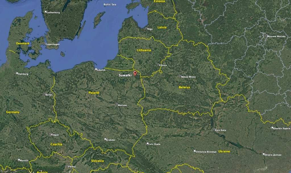
Adding to the concerns about Moscow’s actions, Russia’s client state Belarus just wrapped up mechanized and tank battalion training adjacent to the Suwalki Gap. That’s the border between Poland and Lithuania that separates the Russian enclave of Kaliningrad from Belarus. It has long been considered a potential flashpoint for a war in Europe and the training exercise exacerbated concerns that NATO allies are not prepared for a Russian attack there.

The Suwalki Gap between Kaliningrad and Belarus is also the only land border between Poland and the Baltic states. (Google Earth)

Russia is also making some potentially concerning preparations.

The Defense Ministry is reportedly seeking “an additional 16,000 to 20,000 hospital beds for wounded soldiers in the Northwestern Federal District,” according to the Russian Volya Telegram channel. That district is located near the Baltics.

“Military hospitals have been struggling to cope with the influx of wounded since 2023, so the Ministry of Defense is increasingly using civilian hospitals (including maternity hospitals and specialized medical facilities) for its needs,” Volya stated. “Some of these hospitals are being completely repurposed for military use, but more often, civilian hospitals allocate a few departments to treat the wounded, while continuing to provide care for civilian patients in other departments.”

The expansion “will primarily affect regions within the Northwestern Federal District: Karelia, St. Petersburg, Leningrad and Novgorod regions, as well as Smolensk,” which are near the Baltics “and the Moscow regions.”

While Russia is framing this as a way to handle the influx of wounded from the ongoing conflict, Ukrainian analysts see this as a move to prepare for an expansion of hostilities into Europe.

🤔 Militarnyi: In the fall of 2026, the Russian Federation plans to add 16,000-20,000 military beds in civilian hospitals in the Northwestern Federal District, located near the Baltic states. pic.twitter.com/0sLMvoCxfC

— MAKS 26 🇺🇦👀 (@Maks_NAFO_FELLA) September 15, 2026

In addition, the Border Service Directorate for St. Petersburg and the Leningrad Region announced that from September 16 to September 26, 2026, there would be a restriction on access to the border of the Slantsevsky and Kingiseppsky districts near the Estonian border. 

“These measures aim to prevent violations regarding border regulations, migration laws, and the protection of aquatic biological resources,” the directorate claimed, according to Russian regional officials. 

The new rules prohibit people from being on the shorelines or in small vessels along a portion of the Narva River and from hunting or carrying firearms in the border area. In addition, they forbid the “presence and movement of individuals and vehicles during hours of darkness outside of populated areas within the five-kilometer strip of territory along the state border in the Kingiseppsky and Slantsevsky districts.”

Obviously, the stated reasoning behind this was taken with great skepticism from neighboring Baltic NATO countries who are already on edge.

Russia's FSB imposes a nighttime curfew along the Estonian border near Narva, banning people and vehicles outside towns and villages within 5 km of the border in the Slantsy and Kingisepp districts from Sept 16–26 pic.twitter.com/8Ez8AvMXFy

— Faytuks Network (@FaytuksNetwork) September 20, 2026

Though Russia remains bogged down in its war on Ukraine and is suffering heavy losses of personnel and equipment, some European intelligence officials suggest Vladimir Putin could still carry out a small-scale invasion of NATO territory.

“It’s possible,” Michal Koudelka, the head of the Czech Republic’s BIS security service, told The Guardian about a potential Russian thrust into NATO. “It could involve a limited incursion, false-flag provocations, a massive influence campaign,” he told the publication, adding that this scenario could play out in a matter of “months, not years.”

While Russia has been carrying out a range of hybrid actions against Europe for years, including cyberattacks, drone incursions and sabotage, last month’s foiled attack on Germany’s Leipzig-Halle airport is seen in European intelligence circles as an inflection point.

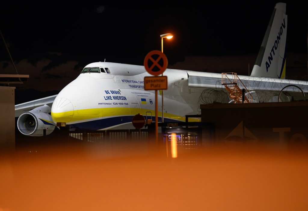
As we previously reported, a drone discovered inside the secured area of Leipzig/Halle Airport during the night of August 4-5, was carrying approximately 1.3 pounds of explosives. It was found close to a Ukrainian-operated Antonov An-124 heavy cargo aircraft used to transport weapons to Ukraine. German authorities blamed Russia for that incident.

“To have an armed UAV drone sent into a busy airport in the middle of Europe … If you have attacks that could result in losses of life or losses of very critical infrastructure that have a huge implication for society, I think that is a gamechanger,” Thomas Nilsson, the head of Sweden’s military intelligence and security service, told The Guardian.

05 August 2026, Saxony, Schkeuditz: A Ukrainian Antonov AN-124 cargo plane is parked at Leipzig/Halle Airport. Following the nighttime drone incident at Leipzig/Halle Airport, specialists from the Federal Police defused a drone equipped with an explosive device. Photo: Hendrik Schmidt/dpa (Photo by Hendrik Schmidt/picture alliance via Getty Images)
A Ukrainian Antonov AN-124 cargo plane is parked at Leipzig/Halle Airport after specialists from the Federal Police defused a drone equipped with an explosive device that German authorities blamed on Russia. (Photo by Hendrik Schmidt/picture alliance via Getty Images) picture alliance

It is unknown at this point whether Putin will decide to expand his hybrid actions against Europe to a more traditional conflict. However, as the attacks increase, officials across the continent are committing greater resources and planning to be prepared should that happen.

At the same time, the heat is only being turned up on Moscow as Ukraine accelerates its long range attacks. Now it has a whole new weapon, one that has been long in the works, to reach into Russian territory with while bypassing most air defenses.

Zelensky has officially unveiled the FP-7 Pelican ballistic missile and said it was used in the attack on Moscow. This is a monumental advance for Ukraine that has lacked modern ballistic missile capabilities since the war started. Still, Ukrainian media has raised doubts about whether the FP-7 — with an estimated operational range of 200-350 kilometers (124-217 miles) — can reach the Russian capital, which is about 450-500 kilometers (280-311 miles) from the Ukrainian border.

However, one expert suggested “that the ballistic weapon may have played an integral role within a coordinated, multi-axis combined strike,” according to the Kyiv Post.

Regardless, even if it can’t hit Moscow, it can hit plenty of other targets and it represents a major escalation in Ukraine’s weapons capabilities.

Ukrainian President Zelensky said that during an attack on Moscow, Ukraine used its Pelican FP-7 ballistic missile for the first time. pic.twitter.com/KqM9bqk9ur

— Visegrád 24 (@visegrad24) September 20, 2026

There is no avoiding the reality that the security situation in Europe is deteriorating, where exactly that leads is unclear apparently to everyone at the moment.

UPDATE: 7:04 PM Eastern –

Airspace restrictions have been imposed over Vilnius Airport due to a suspected “hybrid attack” from Belarus after the detection of what is suspected to be balloons in Lithuanian airspace, airport officials announced.

The restrictions were imposed from 11:45 p.m. local time on September 21 to 02:45 a.m. on September 22, the airport announced on its Facebook page. 

“Aircraft arrivals are temporarily suspended; however, departures are permitted from 12:55 a.m. subject to all safety requirements,” the airport explained. “These restrictions were introduced due to a hybrid attack by Belarus against Lithuania, civil aviation, and the public, involving the detection of navigational markers—characteristic of balloons—in areas posing risks to aviation.”

Belarus launched balloons toward the Vilnius Airport area, in what Lithuanian authorities are describing as a hybrid attack. pic.twitter.com/U7Etg3xn5o

— GMI (@Global_Mil_Info) September 21, 2026

Contact the author: howard@twz.com

The post Alarm Bells Ring Across Europe As Security Situation With Russia Deteriorates At Accelerating Pace appeared first on TWZ.

  •  

Changing the Rules of the Game: Britain and Israel at a Crossroads

Britain’s relationship with Israel is entering a new phase as the E1 settlement dispute collides with wider struggles over the Red Sea, Gaza’s energy resources, IMEC, intelligence technology and post-Brexit influence. As London pressures Israel while maintaining strategic cooperation, the question is whether Britain is changing the rules of the relationship-or preparing for a deeper […]
  •  

How Real Is the Impact of Western Sanctions on Israel?

Europe is getting tougher on Israel in rhetoric and sanctions, but its latest measures may be designed to create political distance from Israel without creating enough economic pain to make Israel change course in the West Bank or anywhere in Palestinian territories. The Arithmetic of Punishment On September 8, Britain, France, Canada and a group […]
  •  

Health workers demand action against genocide and militarization at ManiFiesta 2026

Health is always a prominent topic at Belgium’s ManiFiesta, a two-day festival organized by the Workers’ Party of Belgium (PTB) in the beginning of September. Discussions range from the organization of health services or workshops led by progressive health organizations like Medics for the People (MPLP-GVHV) and Viva Salud. This September, the program covered local priorities such as health coverage and hospital reform – along with Israel’s ongoing assault on Gaza’s healthcare system and the threat of militarization across Europe.

Health workers should oppose rearmament

Addressing the question of why health workers should be concerned by Europe’s armament drive, Juliette Mattijsen of the People’s Health Movement (PHM), Nadja Rakowitz of the Association of Democratic Doctors (vdää*) in Germany, and Tim Joye of Medics for the People emphasized the different ways hospitals, health centers, and medical studies are being reshaped. 

Not only are governments imposing cuts on health budgets to enable increased defense spending, as Mattijsen illustrated – some are structurally changing what the health system is supposed to be about.

Read more: Militarization is spreading through Germany’s health sector

As the Merz administration in Germany rushes to build Europe’s mightiest army, Rakowitz explained, it is tabling plans for underground hospitals and an overhaul of triage systems. The goal of these reforms is supposedly to ensure wounded soldiers – from a battlefield that still only exists in the imagination of regional politicians – are cared for swiftly and returned to combat as soon as possible. In Belgium, Joye added, plans are being circulated to introduce war medicine into medical school curricula, and professional congresses have made this their topic of choice.

If European governments have their way, the speakers warned, health systems in the region will increasingly lose their focus on patients and add further strain on service provision. To prevent this, the panel suggested, health workers themselves – nurses, doctors, dentists, and others – must mobilize and actively oppose this dangerous trend.

In Palestine, medics provide more than health care

At another panel hosted by Viva Salud, the focus shifted to Palestine. Gaza’s health services have been militarized by the Israeli occupation, which has turned health infrastructure and workers into direct targets.

Sama Jaber of the Awda Association and Hanne Bosselaers, a Medics for the People general practitioner who participated in the 2025 solidarity flotillas to Gaza, focused their interventions on the relevance of organizing and providing healthcare under occupation.

In Palestine, Jaber pointed out, the formation of medical practitioners is a collective feat. By persevering in their work during a genocide, health workers in Gaza are now giving back to the communities who accompanied them along the way. “Being a health worker in Palestine today means sharing genocide conditions, but also upholding the right to health,” she said.

Read more: In Palestine, healthcare is also a form of resistance

For Bosselaers, the steadfastness of Palestinian comrades has been an inspiration since her first visits to Gaza approximately 15 years ago and the twinning process she supported with a health center in Beit Hanoun. Today, she emphasized, Israeli attacks have leveled Beit Hanoun to the ground – yet health workers have not given up their work.

Doctors and other health workers in Europe need to recognize this unbreakable spirit, Bosselaers said, and support their peers by joining movements at home. This should mean standing by Palestinians’ demands for liberation, she added, but also joining networks struggling against other forms of attack on healthcare: opposing commercialization, austerity, and militarization.

Call to support boycott, divestment and sanctions

Health workers around the world should direct their efforts into directly supporting the health system in Palestine, the panelists pointed out. This does not mean replacing hospitals with large international NGO operations or flying in and taking over, Bosselaers insisted, as is often seen in humanitarian medicine. Instead, she and Jaber suggested, the priority should be mobilizing against the occupation and campaigning for an end to Israel’s impunity.

In this, they echoed Palestinian physician and political leader Mustafa Barghouti, who addressed the panel through a video message. Barghouti invited health workers in Europe to stand firm in their support of Gaza, particularly by supporting boycott, divestment and sanctions (BDS) campaigns. By doing so, he said, they will also recognize the efforts of their peers in Palestine, who are doing more than healthcare today, “helping people persevere in their steadfastness.”

As the genocide continues, Barghouti insisted, health workers in occupied Palestine know their efforts are directed at supporting people in remaining on their land – starting from the most common health procedures. “If you help a woman safely deliver a baby,” he said, “you’re helping her stay in Palestine.”

People’s Health Dispatch is a monthly bulletin published by the People’s Health Movement and Peoples Dispatch. For more articles and to subscribe to People’s Health Dispatch, click here.

  •  

France, You Are Guilty: How Paris Turned Western Sahara into the Maghreb’s Powder Keg

On September 10, 2026, Algeria announced the severance of diplomatic relations with the United Arab Emirates. The Rupture That Was 50 Years in the Making The UAE ambassador was given 48 hours to leave the country, and as of September 11, Algerian airspace was closed to all Emirati aircraft. The official reason was “provocative and […]
  •  

German Forces Surge Onto Baltic Island In First-Of-Its-Kind NATO Drill

Swedish and German forces are conducting what appears to be the first joint rehearsal of their rapid-reinforcement plans for the Baltic island of Gotland. The exercise is another step in Sweden’s defense planning for an island whose position in the middle of the Baltic gives it an outsized strategic importance for controlling access, protecting the Baltic states, and maintaining NATO’s freedom of movement in a region where Russian military activity remains a persistent concern.

Silver Wotan 2026 / Weiterer Text über ots und www.presseportal.de/nr/179237 / Die Verwendung dieses Bildes für redaktionelle Zwecke ist unter Beachtung aller mitgeteilten Nutzungsbedingungen zulässig und dann auch honorarfrei. Veröffentlichung ausschließlich mit Bildrechte-Hinweis.
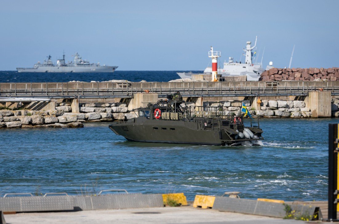
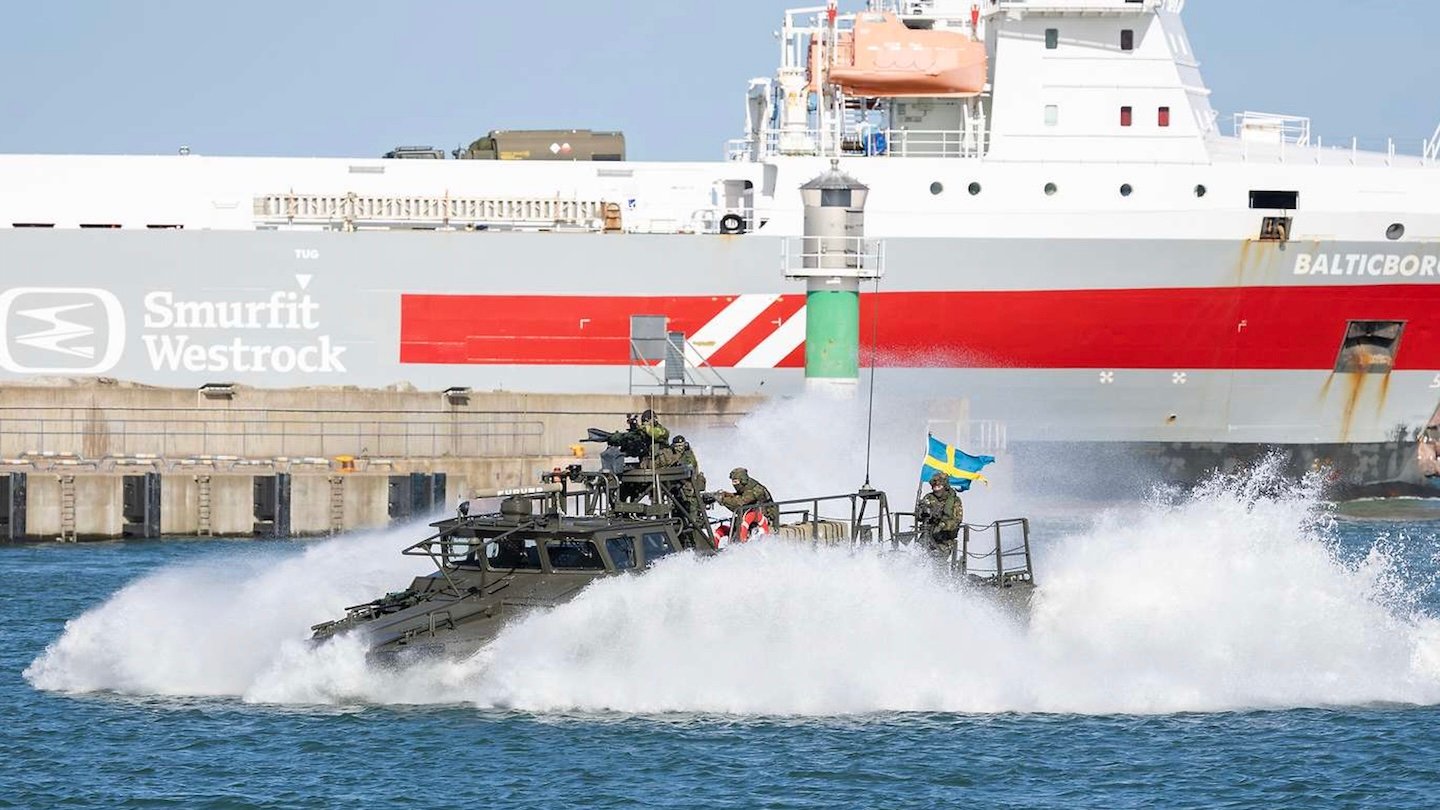
German and Swedish warships stand offshore while a Swedish CB90 fast assault craft operates in the harbor at Visby. Bundeswehr/Marc Tessensohn

The exercise, Silver Wotan 2026, running between September 14-23, brings together Swedish and German forces across the land, maritime, and air domains. The scenario is built around a Swedish request for allied assistance, with German forces moving personnel and equipment across the Baltic before integrating with Swedish units already defending the island. The operation is testing the entire process of getting allied combat power to Gotland, protecting it during the movement to Visby, and rapidly incorporating it into the island’s existing defensive network.

A video shows troops coming ashore on Swedish CB90 fast assault craft, a type that German soldiers are also trained to operate:

A rapid deployment of German and Swedish forces to Gotland island is being carried out today. Units from 🇸🇪 and 🇩🇪 are rehearsing the swift reinforcement of the strategic island in order to ensure the security of the Baltic Sea.#SilverWotan#NATO pic.twitter.com/A0r3LF8XUP

— Försvarsmakten (@Forsvarsmakten) September 18, 2026

The strategic importance of Gotland has grown considerably following Sweden’s accession to NATO in March 2024, which was a direct response to the full-scale Russian invasion of Ukraine.

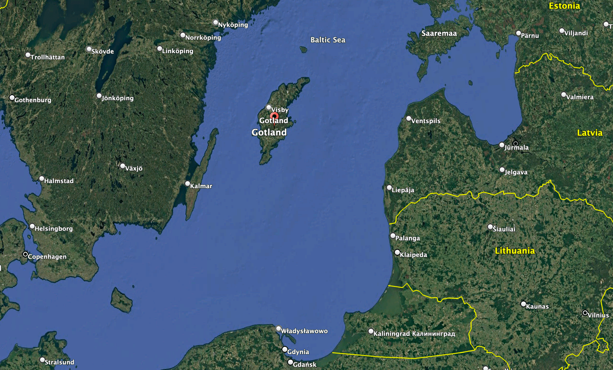
Located approximately halfway between mainland Sweden and the Baltic states, the island occupies a central position in the Baltic Sea, close to the maritime approaches to the Gulf of Finland and within reach of the Russian exclave of Kaliningrad. Its location gives forces operating from Gotland a potentially significant position from which to conduct surveillance, air defense, and maritime operations, while also making the island an important part of the wider network connecting NATO’s northern and eastern members.

The location of Gotland within the Baltic region. Google Earth

At the same time, Gotland sits within an extremely complex littoral environment, where shallow waters, islands, narrow maritime approaches, and the proximity of multiple states can make both offensive operations and defensive planning more difficult. The region has also been shaped by longstanding Swedish concerns about Russian clandestine activity, including intelligence gathering and other forms of covert or deniable activity. The complexity of the Baltic operating environment can make such activities harder to detect and attribute, adding another layer of uncertainty alongside the more conventional military challenges facing the region.

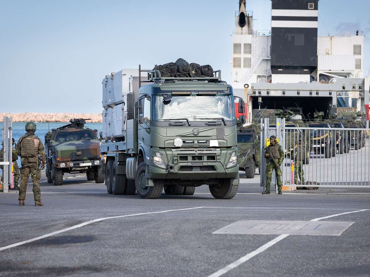
The unloading operation in Visby. The vehicles seen here were transported by sea from Karlskrona to the Swedish mainland. Bundeswehr/Marc Tessensohn

Geography has long made Gotland important to Swedish defense planning, but its significance has taken on a broader dimension since Sweden joined the alliance. NATO has described the island as strategically important to its freedom of maneuver in the Baltic, while Swedish officials have highlighted its potential role as a hub for military operations and logistics in the region.

The current exercise is designed around the practical difficulties of reinforcing such a position.

Military equipment is being transported by sea to Visby, Gotland’s principal port, including by commercial ferry. In Visby, Swedish and German personnel are securing the harbor and conducting the reception of the arriving force. Among the equipment being moved are air defense systems, while Swedish forces are also operating coastal defense systems armed with anti-ship missiles.

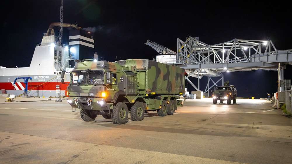
German Army vehicles roll into Visby during Silver Wotan. Bundeswehr/Marc Tessensohn

Meanwhile, publicly available flight-tracking data showed German Luftwaffe transport aircraft, including at least one Airbus A400M airlifter, apparently involved in the effort. The commercial airport at Visby has long also been used for military activities related to Gotland and the wider Baltic region.

”A rapid deployment of German and Swedish forces to Gotland island is being carried out today” https://t.co/z6oLs1LCT4 pic.twitter.com/n18MdST6r1

— Jamming (@balticjam) September 18, 2026

The movement is supported by Swedish and German naval forces and other aircraft, creating a scenario in which the maritime transit, protection of the port, air operations, and subsequent movement of troops and equipment ashore all form part of the same military problem. Once ashore, the arriving forces have to be moved into position and integrated with Swedish units already responsible for defending the island.

The Swedish Gotland Regiment, P 18, provides the core of the island’s permanent military presence. The regiment, Sweden’s youngest and smallest, has been rebuilding its capabilities since Sweden began expanding its military presence on Gotland. Its forces form the basis of the ground-defense structure into which allied reinforcements would be incorporated.

Soldiers of the P18 Gotland Regiment of the Swedish Army camouflage an armoured vehicle during a field exercise near Visby on the Swedish island of Gotland on May 17, 2022. Finland and Sweden are expected to announce this week whether to apply to join NATO following Russia's Ukraine invasion, in what would be a stunning reversal of decades-long non-alignment policies. On Sweden's strategically-located Baltic Sea island of Gotland, Home Guard troops were last week called in for a special month-long training exercise, coinciding with annual military exercises taking place across Finland and Sweden next week. (Photo by Jonathan NACKSTRAND / AFP) (Photo by JONATHAN NACKSTRAND/AFP via Getty Images)
Soldiers of the Gotland Regiment of the Swedish Army camouflage an armoured vehicle during an earlier field exercise near Visby. Photo by Jonathan NACKSTRAND / AFP

Swedish coastal defense capabilities are another important element of the drill. Land-based anti-ship missiles provide the island with a means of threatening hostile surface vessels operating in the surrounding waters, giving the defense of Gotland a direct connection to the wider maritime battle for the Baltic. During Silver Wotan, Swedish and German forces are also conducting anti-surface warfare activities alongside the broader reinforcement operation.

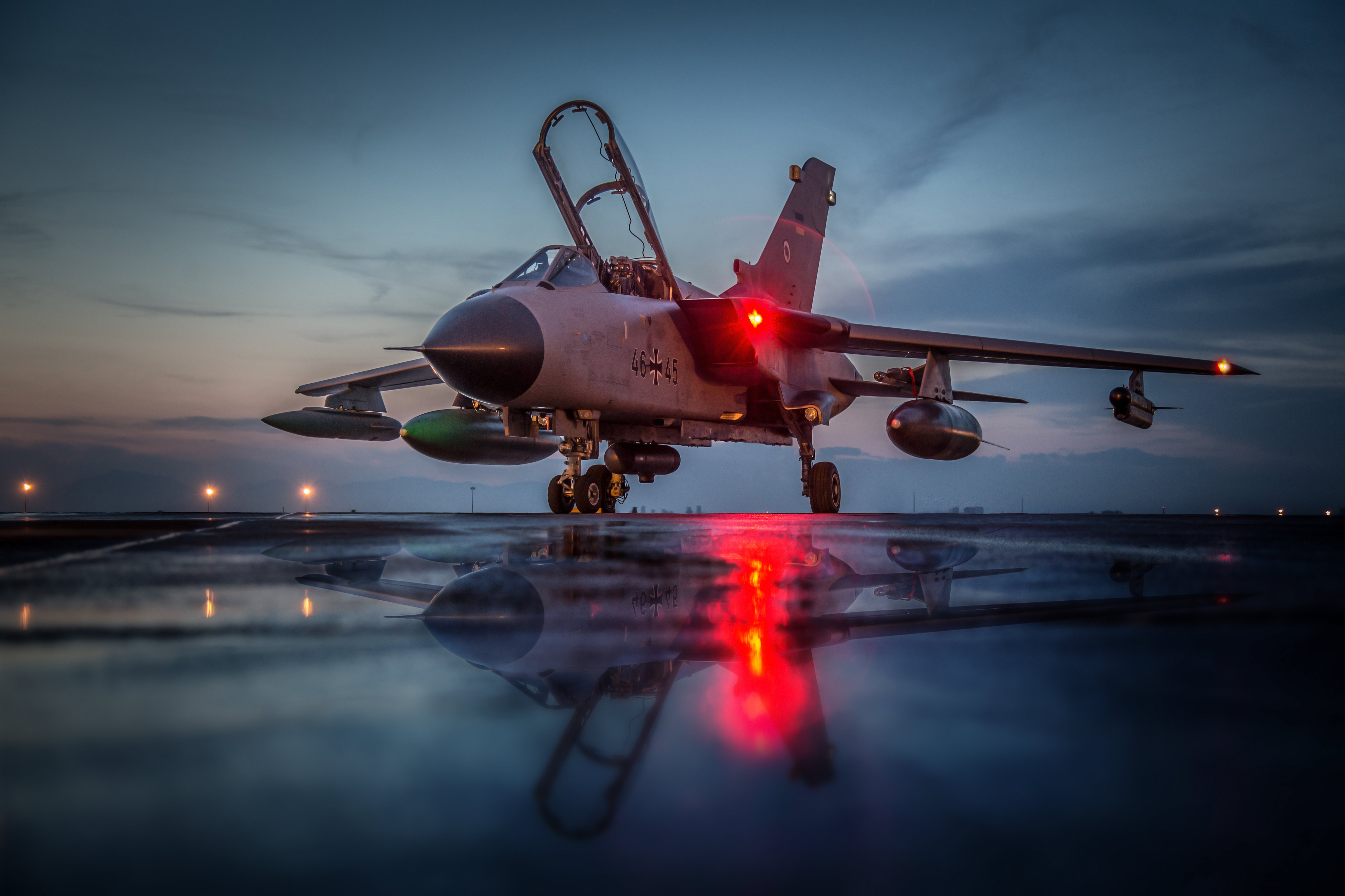
Germany is contributing more than 500 troops to the exercise, part of approximately 2,000 Bundeswehr personnel involved, including elements from the army, navy, and air force. The German Luftwaffe has deployed Panavia Tornado aircraft for surveillance, while German naval forces are participating in the maritime component, and German ground personnel are involved in the reinforcement and security activities on Gotland.

Piloten mit einer Nachtsichtbrille im Cockpit des Tornados 46+45 im Rahmen der Mission Counter Dash in Incirlik, Türkei, am 14.04.2016
Stock photo of a Luftwaffe Tornado ECR equipped for a reconaissance mission. Bundeswehr

The exercise scenario is particularly relevant against the backdrop of Russia’s continuing military presence in the Baltic region.

Russia maintains major military infrastructure in Kaliningrad, including naval, air, missile, and air defense capabilities, while the Russian Baltic Fleet operates from bases in the region. Kaliningrad’s position between Poland and Lithuania gives Moscow a significant military foothold inside the NATO area, while Russian forces and military infrastructure elsewhere along the Baltic add to the complexity of operating and reinforcing allied territory in the region.

The security environment around the Baltic has also deteriorated considerably since Russia’s full-scale invasion of Ukraine. NATO has increased its surveillance and military activity in the region, including the launch of Baltic Sentry in January 2025 following a series of incidents involving critical undersea infrastructure. The alliance has subsequently expanded efforts to monitor maritime activity and protect infrastructure and sea lines of communication.

A picture taken on February 4, 2025 shows a Helicopter 15 (HKP15) (L) on the flight deck of patrol ship HMS Carlskrona (P04) on open water near Karlskrona, Sweden, as part of the NATO Baltic Sea patrol mission, the Baltic Sentry, aimed to secure critical underwater infrastructure. The patrol ship HMS Carlskrona (P04) set off from the naval port in Karlskrona on February 4, 2025 to become part of NATO's Baltic Sentry operation as one of several Swedish ships that are part of Standing NATO Maritime Group One (SNMG1). This is the first time the ship has hoisted the NATO flag on board. The purpose of NATO's Baltic Sentry operation is to demonstrate presence and secure critical underwater infrastructure. (Photo by Johan NILSSON / TT NEWS AGENCY / AFP) / Sweden OUT (Photo by JOHAN NILSSON/TT NEWS AGENCY/AFP via Getty Images)
A Swedish Navy Helicopter 15 on the flight deck of patrol ship HMS Carlskrona as part of the NATO Baltic Sea patrol mission, Baltic Sentry, aimed to secure critical underwater infrastructure. Photo by Johan NILSSON / TT NEWS AGENCY / AFP

Swedish authorities have stressed that Silver Wotan was planned in advance and is not being conducted in response to a specific imminent Russian threat. The exercise nonetheless reflects the operational environment in which Swedish and NATO planners now have to consider the possibility that maritime and air movements across the Baltic could be monitored, disrupted, or contested.

The exercise also builds on a series of increasingly large Swedish-led activities designed to test the reception of allied forces on Swedish territory. During Aurora 26 earlier this year, more than 18,000 troops from 13 countries participated in operations across Sweden, including the deployment of allied forces to Gotland alongside the Gotland Regiment and Swedish Home Guard. NATO described that activity as an emergency deployment intended to test the reinforcement of the island.

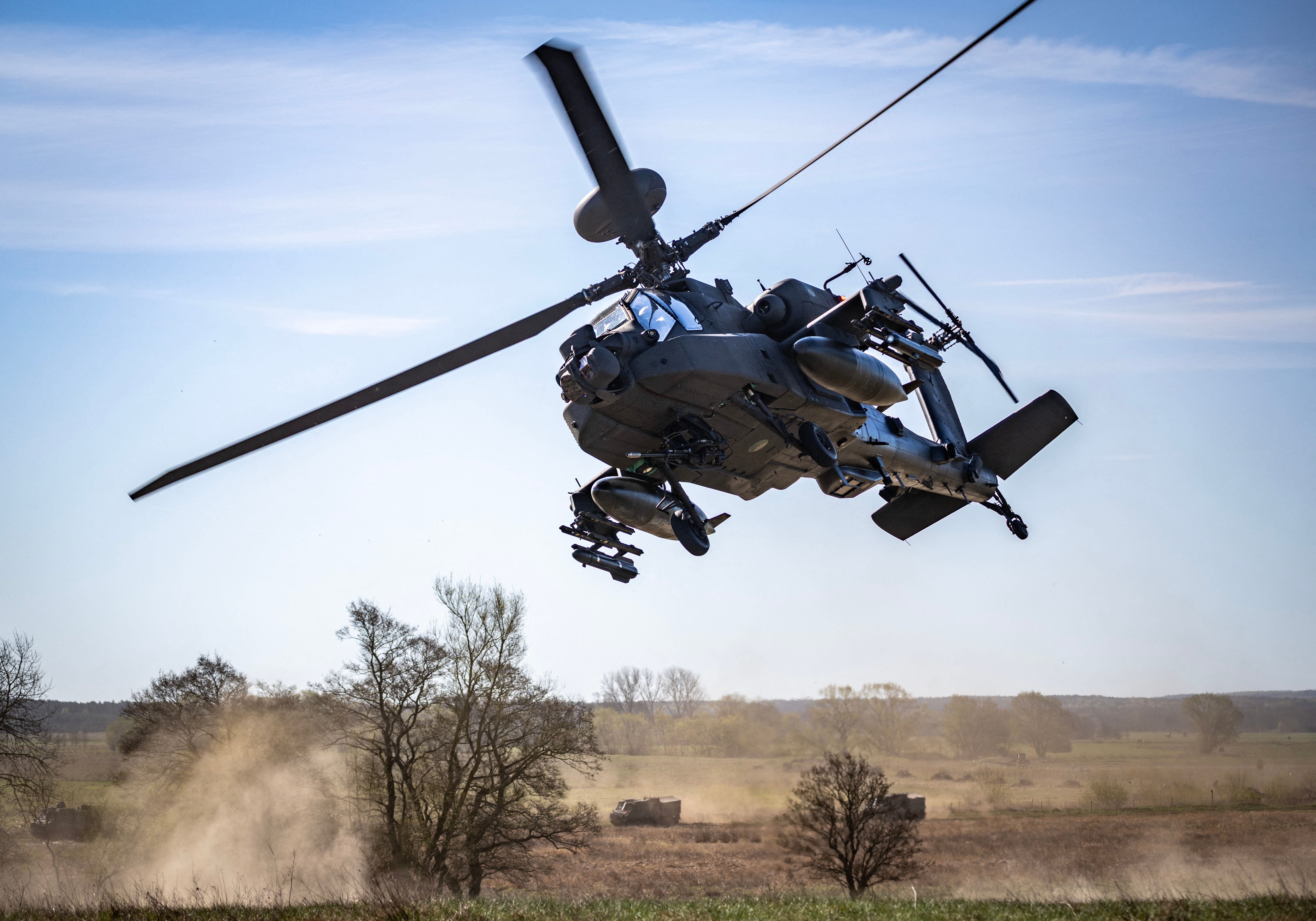
A Dutch Boeing AH-64 Apache attack helicopter takes part in a combat display during a press day for the military exercise Aurora 26 at the Revingehed training field outside Lund in Skane, Southern Sweden on April 29, 2026. The exercise at Revingehed includes personnel from several NATO countires with the focus on lessons learned from the war in Ukraine including drones. (Photo by Johan NILSSON / various sources / AFP via Getty Images) / Sweden OUT
A Dutch AH-64 Apache attack helicopter takes part in Exercise Aurora 26 in southern Sweden on April 29, 2026. Photo by Johan NILSSON / various sources / AFP

Silver Wotan places a more concentrated emphasis on the Swedish-German relationship and on the movement of an allied force into the island’s existing defensive structure.

Germany’s participation is also consistent with its growing military role in the Baltic and along NATO’s northeastern flank. Berlin is already providing forces for NATO’s forward defense in Lithuania and has increasingly emphasized the ability to move German forces rapidly across northern Europe in support of allied operations.

For Sweden, meanwhile, Gotland has become one of the clearest examples of how NATO membership has changed the country’s defense planning. The island remains a Swedish responsibility, but its location means that what happens there has consequences well beyond Sweden’s territorial defense.

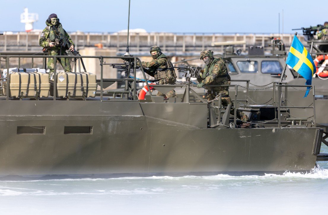
Silver Wotan 2026 / Weiterer Text über ots und www.presseportal.de/nr/179237 / Die Verwendung dieses Bildes für redaktionelle Zwecke ist unter Beachtung aller mitgeteilten Nutzungsbedingungen zulässig und dann auch honorarfrei. Veröffentlichung ausschließlich mit Bildrechte-Hinweis.
German and Swedish troops on a Swedish CB90 fast assault craft. Bundeswehr/Marc Tessensohn

A defended and adequately supplied Gotland provides NATO with a strategically positioned base for surveillance and defensive operations in the Baltic, while the ability to reinforce it demonstrates that the alliance can maintain access to the island even as the surrounding maritime and air environment becomes more contested.

The exercise comes as European allies are being forced to plan for a NATO in which the United States may provide less of the conventional military weight it has supplied for decades. The Pentagon is reviewing the size and posture of U.S. forces in Europe, including the forces and capabilities Washington would make available in a European crisis, while NATO’s top commander has said further U.S. troop withdrawals should be expected as European allies build up their own conventional capabilities.

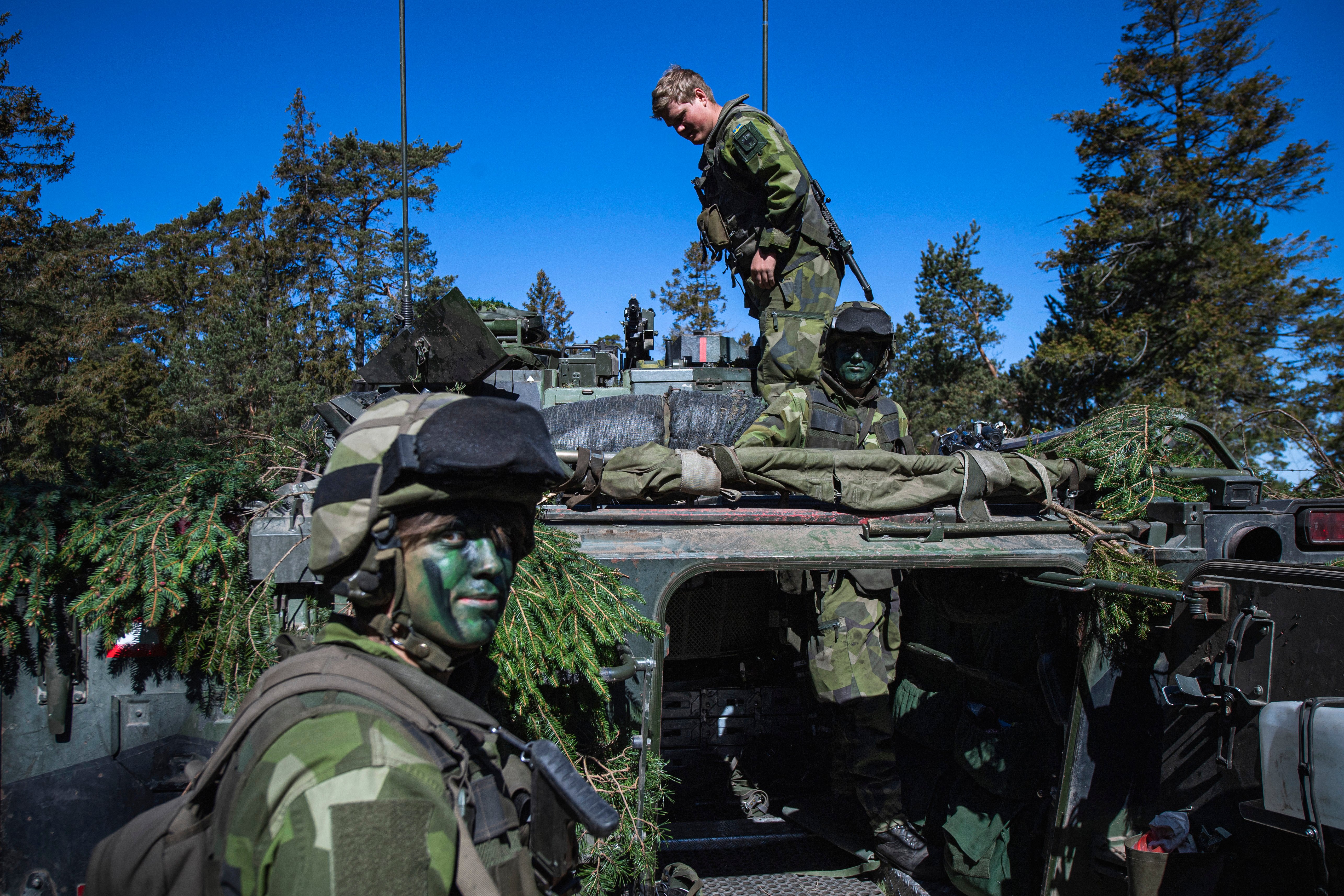
Silver Wotan 2026 / Weiterer Text über ots und www.presseportal.de/nr/179237 / Die Verwendung dieses Bildes für redaktionelle Zwecke ist unter Beachtung aller mitgeteilten Nutzungsbedingungen zulässig und dann auch honorarfrei. Veröffentlichung ausschließlich mit Bildrechte-Hinweis.
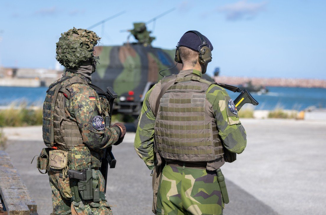
A German and a Swedish soldier involved in securing Visby during Silver Wotan 2026. Bundeswehr/Marc Tessensohn

At the same time, the alliance now describes Russia as its most significant and direct security threat, citing military activity alongside airspace violations, sabotage, cyber operations, and other forms of hybrid pressure. There are also growing concerns that Russia could try something in the Baltics, while it continues to step up its gray-zone activities regardless. NATO officials have warned that Russia could rebuild enough military capacity to pose a more serious conventional challenge to the alliance before the end of the decade.

There are escalating warnings from Poland that Russia is preparing to widen its war against Ukraine, with "accidental" missile and drone strikes on NATO territory.

Such a move – Russia falsely claiming air strikes that hit NATO allies happened by accident – would be designed to…

— Deborah Haynes (@haynesdeborah) September 18, 2026

For Sweden and Germany, the Silver Wotan exercise is a practical test of how quickly European forces can reinforce and defend one of the Baltic’s most strategically important positions. As the security environment grows more contested and Europe prepares for a future in which U.S. forces may not be as readily available, the ability to move allied combat power across the region and integrate it into existing defenses is becoming an increasingly important part of NATO’s deterrence.

Contact the author: thomas@thewarzone.com

The post German Forces Surge Onto Baltic Island In First-Of-Its-Kind NATO Drill appeared first on TWZ.

  •  

Una pequeña victoria frente a los mapas que sitúan al Norte Global en el centro y empequeñecen a África.

Read in English here

La semana pasada, el 4 de septiembre, la Asamblea General de las Naciones Unidas aprobó una propuesta africana para un nuevo mapa mundial, que muestra el tamaño real de los países en relación con los demás. Su objetivo es corregir la visión del mundo moldeada por el mapa mundial ampliamente utilizado basado en la proyección de Mercator, creada por Gerardus Mercator, un cartógrafo flamenco del siglo XVI. El problema con el mapa de Mercator es bien conocido; por ejemplo, muestra a la isla de Groenlandia con el mismo tamaño que el continente africano, ¡a pesar de que África es 14 veces más grande que Groenlandia! En pocas palabras, los mapas de Mercator exageran enormemente el norte del mundo —los Estados Unidos y Europa— mientras que reducen África y la mayor parte de Asia. Tampoco trata con benevolencia al resto del hemisferio sur. Sudamérica, que tiene casi tres veces el tamaño de Europa, parece comparable a esta en un mapa típico de Mercator.

Aunque no existe ninguna razón geográfica por la que el hemisferio sur deba ser más pequeño que el hemisferio norte, los cartógrafos lo hicieron significativamente más pequeño porque tenía muy poca masa continental más allá de los 40 grados y, por lo tanto, se recortó. Esto significó que, en la mayoría de los mapas de Mercator, debido a que los cartógrafos occidentales recortaron gran parte del hemisferio sur, el ecuador quedó significativamente desplazado hacia abajo. El doble efecto de comprimir las zonas ecuatoriales, donde se encuentra gran parte de África, y desplazar el ecuador hacia abajo hizo que el norte del mundo, particularmente Europa y América del Norte, parecieran mucho más grandes de lo que realmente son. Por lo general, en la mayoría de los mapas de Mercator, el hemisferio norte parece el doble del tamaño del hemisferio sur, aunque ambos hemisferios son idénticos en tamaño.

Cualquier mapa, ya sea de Mercator o de cualquier otra proyección, presenta el problema de que se puede ser fiel al tamaño o a la forma, pero no a ambos. Se trata de un problema fundamental que surge al proyectar una superficie tridimensional sobre una hoja de papel bidimensional. No hay forma de hacerlo sin distorsiones. Solo un globo terráqueo puede representar fielmente la Tierra tridimensional. Pero entonces, ¿qué hacemos cuando queremos reproducir detalles geográficos para nuestros lectores en libros o artículos?

Las distorsiones evidentes de la proyección de Mercator y su enfoque eurocéntrico dieron lugar a varias alternativas, particularmente entre los cartógrafos de la izquierda amplia o progresista. Otros, especialmente en los Estados Unidos y Europa, se han opuesto a ella, argumentando que el tamaño no importa y que no les molesta que se les muestre mucho más grandes de lo que realmente son. Sin embargo, muchos discreparon e intentaron desarrollar proyecciones alternativas. La proyección de Gall-Peterson, que contó con el respaldo del gobierno socialdemócrata alemán de Willy Brandt, es una de esas proyecciones. La proyección de Hobo Dyer, que se encuentra en el dominio público global —lo que significa que cualquiera puede usarla sin pagar regalías—, es otra. Finalmente, las Naciones Unidas han puesto fin a las guerras de los mapas, con una victoria rotunda a favor de la moción presentada por las naciones africanas para utilizar mapas de área igual. La votación fue de 164 a favor de la moción, con los Estados Unidos como único voto en contra.

El objetivo del mapa de Mercator era facilitar la navegación de los barcos en mar abierto, donde ya no es posible orientarse reconociendo diversas características topológicas, como ríos, colinas, aldeas, pueblos, etc. En mar abierto, si identificamos nuestra ubicación en un mapa de Mercator y el destino al que deseamos llegar, podemos viajar en línea recta, tal como se muestra en el mapa. Conserva la dirección, lo que significa que, si trazamos un rumbo en un mapa de Mercator, podemos fijar nuestro rumbo según él. Es por eso que los países marítimos utilizaban proyecciones de Mercator para la navegación cuando contaban con pocos instrumentos, más allá de la brújula y el sextante, para determinar su ubicación con respecto a su destino.

Es importante señalar que la dirección que se muestra en el mapa no es la ruta más corta entre el punto de partida y el destino.

El camino más corto entre dos puntos en la superficie del globo terráqueo es el arco del gran círculo que va desde su ubicación hasta su destino. Una línea recta en un mapa bidimensional puede parecer la distancia más corta, pero no lo es, ya que no toma en cuenta la curvatura de la Tierra. En pocas palabras, el precio que pagamos por convertir una superficie curva en una plana y bidimensional es que distorsionamos la forma de la superficie. Estiramos ciertas áreas y encogemos otras. En una Tierra plana, la distancia más corta sería la que indica su brújula, pero no así en una esfera.

Anteriormente, los barcos utilizaban las estrellas y el sol del mediodía para estimar dónde se encontraban y hacia dónde debían dirigirse. Fijar un rumbo hacia su destino utilizando un mapa de Mercator y una brújula resultaba mucho más sencillo que tratar de adivinar dónde se encontraba en un océano desierto, sin puntos de referencia, y cambiar constantemente de rumbo en busca de una ruta más corta. La línea constante en el mapa se denominaba “línea de rumbo”, y seguirla ayudaba enormemente a los navegantes. Los mapas de Mercator eran populares en Europa, particularmente en Europa occidental, ya que, aparte de los árabes, eran las principales naciones marítimas.

Mientras que los árabes se enfocaban en el comercio, particularmente en el Océano Índico, los europeos occidentales se dedicaban no solo a la pesca, sino también, fuera de temporada, a la piratería, las incursiones y el saqueo de otras naciones. Los vikingos, importantes figuras románticas en Hollywood, eran particularmente brutales, ya que combinaban el saqueo con el comercio de esclavos. Por supuesto, como todos los piratas, una vez que se alcanza el poder, se puede convertir ese poder marítimo en conquista. Los hombres del norte, o nórdicos, conquistaron Francia y más tarde Inglaterra, y son conocidos por nosotros como normandos. No muy diferentes de las Compañías Holandesa y Británica de las Indias Orientales, que comenzaron con el comercio y la piratería y más tarde establecieron imperios coloniales.

No es de extrañar que los reinos marítimos de Europa occidental, para quienes la guerra, la pesca para alimentarse y la caza de focas, morsas, etc., con el fin de obtener grasa y pieles, constituían las principales fuentes de riqueza, se centraran mucho más en la navegación y la construcción naval. Esto significaba que los barcos construidos para el agitado Océano Atlántico contaban con ciertos avances de los que carecían los barcos árabes e indios, aunque la brújula, el astrolabio, los mapas astronómicos y otros instrumentos náuticos procedían todos de Asia.

Los barcos de Europa occidental contaban con cañones montados en cubierta, lo que les permitía disparar “andanadas”, es decir, disparar múltiples cañones simultáneamente, a diferencia de los cañones montados en la proa y la popa. Esa es una de las principales razones por las que un puñado de países de Europa occidental pudo aprovechar los océanos para, primero, hacerse con el comercio marítimo y, más tarde, construir sus imperios coloniales. A diferencia de los fuertes fijos, los barcos actuaban como fuertes flotantes, lo que proporcionaba a los europeos una movilidad en las guerras navales de la que carecían las fortificaciones terrestres estáticas.

Como muestra la monumental obra de Needham sobre la ciencia y la tecnología chinas, muchos avances náuticos en la construcción naval y la navegación procedían de China. Los siete viajes de los barcos de Zheng He en el siglo XV (1405-1443), que partieron de China, el sudeste asiático y la India, y recorrieron la costa árabe hasta África, demostraron que los chinos habían construido enormes barcos y una poderosa armada. En aquella época, se encontraban muy por delante de Europa y de los árabes, tanto en la construcción naval como en los buques de guerra. Las diferencias internas entre la aristocracia terrateniente y los comandantes navales condujeron a la destrucción de la armada y a la prohibición de construir cualquier buque de alta mar.

Aunque la India suministraba a los árabes la madera necesaria para la construcción naval y en algún momento contó con una poderosa armada, cedió el comercio de alta mar a los comerciantes árabes. Ni China, ni la India, ni los árabes consideraban que la armada tuviera importancia militar. Como dijo un emperador mogol: “Los océanos son para los comerciantes, no para nosotros, los guerreros”. Las divisiones de castas en la India también llevaron, en un momento dado, a prohibir a las castas superiores emprender viajes oceánicos. La travesía del Kala Pani, siempre prohibida por los brahmanes, no se respetó de manera estricta. La India experimentó una gran expansión marítima en el período budista, no a través de la guerra, sino mediante el comercio y la labor de proselitismo de los monjes budistas. Tras el resurgimiento del hinduismo en el sur, el tabú que prohibía a las castas superiores viajar a través de los océanos se aplicó de manera más estricta, dejando los océanos en manos de comerciantes y mercenarios. Por ejemplo, las principales flotas de los reyes indios – ya fuera el rey de Calicut, también conocido como Samundri o Zamorin, o Shivaji – dependían de comandantes navales y buques mercenarios, muchos de ellos al mando de árabes.

Como demuestra la historia, los mapas, el comercio marítimo y la guerra están íntimamente relacionados. Los viajes marítimos y las guerras navales confieren a los mapas una importancia estratégica. No es simplemente la ubicación de las fronteras de cada país lo que importa, sino también su visión estratégica del mundo. Podemos observar cómo esto se está manifestando actualmente en Bab el Mandeb y en el Golfo Pérsico. Un vistazo rápido a un mapa habría convencido a los líderes estadounidenses de que Irán cuenta con una clara ventaja estratégica en el Estrecho de Ormuz, al igual que los hutíes en el Mar Rojo y el paso hacia el Canal de Suez. Descuidar los océanos repite los errores que cometió Asia en una época diferente, errores de los que ha aprendido. Debemos tener esto presente también hoy en día.

Prabir Purkayastha es el editor fundador de Newsclick.in, una plataforma de medios digitales. Es activista en favor de la ciencia y del software libre.

Este artículo fue elaborado por Globetrotter.

  •  

A small victory against the maps which center the global north and shrink Africa

Lee en español aquí

On September 4, the United Nations General Assembly adopted an African proposal for a new world map, which shows countries’ true size relative to one another. It aims to correct the view of the world shaped by the widely used world map based on the Mercator Projection, created by Gerardus Mercator, a 16th-century Flemish cartographer. The problem with the Mercator Map is well known; for example, it shows the island of Greenland as the same size as the African continent, even though Africa is 14 times the size of Greenland! Simply put, Mercator maps greatly exaggerate the global north – the US and Europe – while shrinking Africa and most of Asia. Nor does it treat the rest of the Southern Hemisphere kindly. South America, nearly three times the size of Europe, looks comparable to it on a typical Mercator map.

Though there is no geographical reason the Southern Hemisphere should be smaller than the Northern Hemisphere, mapmakers made it significantly smaller because it had very little landmass beyond 40 degrees and was therefore cropped out. This meant that on most Mercator maps, because Western mapmakers cropped out much of the Southern Hemisphere, the equator was significantly displaced downward. The double whammy of squeezing the equatorial areas, where much of Africa lies, and shifting the equator down made the global north, particularly Europe and North America, seem much larger than they actually are. Typically, on most Mercator maps, the Northern Hemisphere looks twice the size of the Southern Hemisphere, though the two hemispheres are identical in size.

Alternatives to the Mercator projection

Any map, whether Mercator or any other projection, has the problem that you can be true to either size or shape, but not both. The problem is a fundamental one of projecting a three-dimensional surface to a two-dimensional piece of paper. There is no way of doing this without distortions. Only a globe can truly represent the three-dimensional earth faithfully. But then what do we do when we want to reproduce geographical details for our readers in books or articles? 

The blatant distortions of the Mercator projection and its Eurocentric approach gave rise to several alternatives, particularly among broad-left or progressive cartographers. Others, particularly in the US and Europe have opposed it, arguing that size does not matter and that they were comfortable being shown much bigger than they actually are. But many dissented and tried to work out alternate projections. The Gall-Peterson projection, which was backed by the German social democratic government of Willy Brandt, is one such projection. The Hobo Dyer projection, which is in the global commons, meaning anybody can use it without paying royalties, is another one. Finally, the United Nations has ended the map wars, with a resounding victory for the motion moved by the African nations for using equal area maps. The voting was 164 in favor of the motion with the US casting the only nay vote.

Read more: US votes against UN resolution promoting maps reflecting Africa’s true size

The objective of Mercator map was for ships navigating in open seas, where we can no longer navigate recognizing various topological features, rivers, hills, villages, towns, etc. On the open ocean, if we identify where we are on a Mercator map and the destination we want to reach, we can travel in a straight line, as shown on the map. It conserves direction, meaning if we plot a course on a Mercator map, we can set our course by it. That is why ocean-going countries used Mercator projections for navigation when they had few instruments beyond the compass and the sextant to determine where they were relative to their destination. 

It is important to note that the direction shown on the map is not the shortest path between where you start from and your destination. The shortest path on two points on the surface of the globe is the arc of the great circle from where you are to your destination. A straight line on a 2-dimensional map may look like the shortest distance, but it is not as it does not account for the Earth’s curvature. Simply put, the price we pay for converting a curved surface to a flat 2-dimensional one is that we distort the shape of the surface. We stretch certain areas and shrink others. On a flat earth, the shortest distance would be what your compass shows, but not on a sphere.

Earlier, ships used stars and the midday sun to estimate where they were and where they needed to go. Setting a course to your destination using a Mercator map and a compass was much easier than trying to guess where you were on an empty ocean with no landmarks and constantly changing course for a shorter route. The constant line on the map was called the thumb line, and following it greatly helped the seafarers. Mercator maps were popular in Europe, particularly in Western Europe, because, apart from the Arabs, they were the major ocean-going nations.

Trade and piracy in the colonial era

While the Arabs focused on trade, particularly in the Indian Ocean, Western Europeans focused not only on fishing but, in the off-season, on piracy, raiding, and looting other nations. The Vikings, major romantic figures in Hollywood, were particularly brutal, combining loot with slave trade. Of course, like all pirates, once you become powerful, you can convert that ocean power into conquest. The northern men, or Norsemen, conquered France and later England, and are known to us as Normans. Not very different from the Dutch and the British East India Companies, starting with trade and piracy and later establishing colonial empires.

Not surprisingly, the ocean-going kingdoms of Western Europe, for whom war and fishing for food and hunting seals, walrus, etc., for blubber and skins were major sources of wealth, focused much more on seafaring and shipbuilding. This meant ships built for the rougher Atlantic Ocean had certain advances that Arab and Indian ships did not, though the compass, astrolabe, astronomical maps, and other nautical instruments all came from Asia.

Western European ships had deck-mounted cannons, which allowed them to fire “broadside,” meaning multiple cannons firing simultaneously, unlike the front- and rear-mounted cannons. That is one of the major reasons a handful of West European countries could use the oceans to first capture the ocean trade and later build their colonial empires. Unlike fixed forts, ships acted as floating ones, giving Europeans mobility in naval wars that static ground fortifications lacked.

Ocean navigation and development in Asia

As Needham’s monumental work on Chinese science and technology shows, many nautical advances in shipbuilding and navigation came from China. Seven voyages by Zheng He’s ships in the 15th century (1405-1443), which traveled from China, Southeast Asia, India, and down the Arab coast to Africa, showed that the Chinese had built huge ships and a powerful navy. At that time, they were well ahead of Europe and the Arabs, in both shipbuilding and warships. Internal differences between the landed aristocracy and the naval commanders led to the navy’s destruction and a ban on building any oceangoing ships.

Although India supplied the timber necessary for shipbuilding to the Arabs, and once had a powerful navy, it ceded the oceangoing trade to Arab merchants. Neither China, India, nor the Arabs saw the navy as militarily important. As one Mughal Emperor said, Oceans are for traders, not us, the warriors. Caste divisions in India also led, at one point, to barring upper castes from undertaking ocean voyages. Crossing Kala Pani, always forbidden by the Brahmins, was not strictly followed. India saw major maritime expansion in the Buddhist period, not by war but through trade and proselytizing Buddhist monks. After the revival of Hinduism in the South, the taboo against upper-caste travel across oceans was enforced more strictly, leaving the oceans to traders and mercenaries. For example, the major fleets of the Indian kings, whether the King of Calicut, also known as Samundri or Zamorin, or Shivaji, relied on mercenary naval commanders and ships, many commanded by the Arabs.

As history shows, maps, ocean trade, and war are intimately connected. Ocean voyages and naval wars make maps strategically important. It is not simply where each country’s borders lie that is important, but also how it strategically views the world. We can see this currently playing out in the Bab-al-Mandeb and the Persian Gulf. A quick look at a map would have convinced US leaders that Iran has a clear strategic edge in the Strait of Hormuz, just as Ansar Allah do in the Red Sea and the passage to the Suez Canal. Neglecting the oceans repeats the mistakes Asia made in a different age, mistakes from which it has learned. We need to bear this in mind today as well.

Prabir Purkayastha is the founding editor of Newsclick.in, a digital media platform. He is an activist for science and free software. 

This article was produced by Globetrotter.

  •  
❌